MyTopo
Bowie Texas US Topo Map
Couldn't load pickup availability
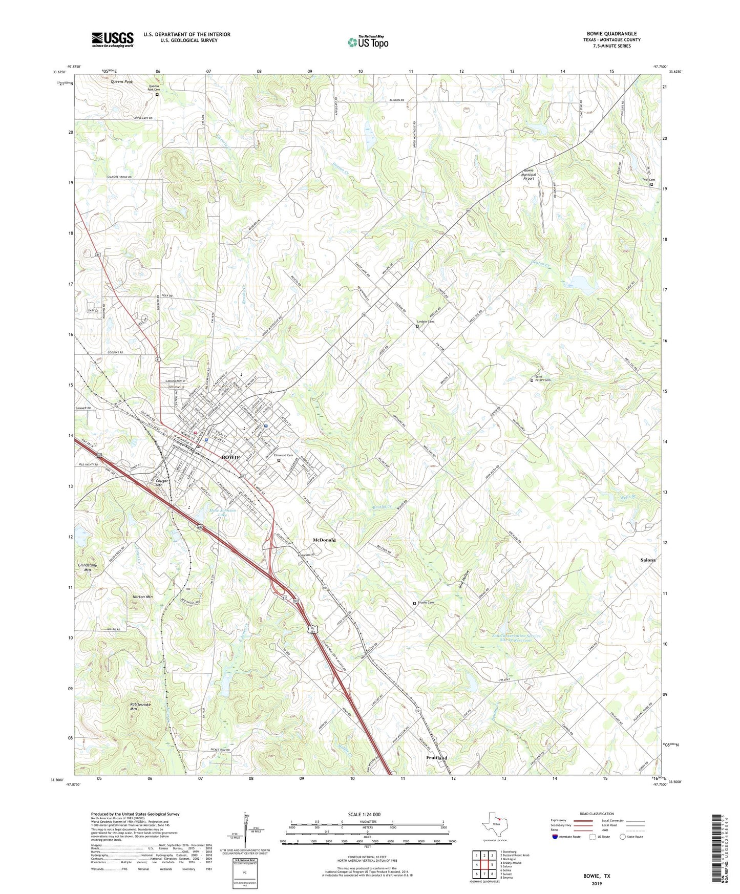
2019 topographic map quadrangle Bowie in the state of Texas. Scale: 1:24000. Based on the newly updated USGS 7.5' US Topo map series, this map is in the following counties: Montague. The map contains contour data, water features, and other items you are used to seeing on USGS maps, but also has updated roads and other features. This is the next generation of topographic maps. Printed on high-quality waterproof paper with UV fade-resistant inks.
Quads adjacent to this one:
West: Brushy Mound
Northwest: Stoneburg
North: Buzzard Roost Knob
Northeast: Montague
East: Salona
Southeast: Smyrna
South: Sunset
Southwest: Selma
Contains the following named places: Bible Baptist Church, Big Sandy Creek Dam Number 10, Bird Hollow, Bowie, Bowie Baptist Mission Church, Bowie City Hall, Bowie Division, Bowie Elementary School, Bowie Fire Department and Emergency Medical Service, Bowie High School, Bowie Junior High School, Bowie Memorial Hospital, Bowie Municipal Airport, Bowie Police Department, Bowie Post Office, Bowie Primary School, Brushy Cemetery, Central Baptist Church, City of Bowie, Cougar Mountain, East Side Baptist Church, East Ward School, Elmwood Cemetery, First Baptist Church, Fort Worth and Denver City Depot, Fruitland, Grindstone Mountain, Hispanic Baptist Mission Church, Jackrabbit Stadium, KRJT-AM (Bowie), Lindale Cemetery, Lone Star Church, McDonald, Meyers Park, Mose Johnson Lake, Mose Johnson Lake Dam, Mueller Oil Field, North Ward School, Norton Mountain, Osage Oil Field, Pelham Park, Pleasant Ridge Church, Queens Park Cemetery, Rattlesnake Mountain, Saint Jerome Catholic Church, Saint Peters Cemetery, Seventh Day Adventist Church, Soil Conservation Service Site 10 Dam, Soil Conservation Service Site 10 Reservoir, Soil Conservation Service Site 18 Dam, Soil Conservation Service Site 18 Reservoir, Soil Conservation Service Site 1a Dam, Soil Conservation Service Site 1a Reservoir, Soil Conservation Service Site 1b2 Dam, Soil Conservation Service Site 1b2 Reservoir, Soil Conservation Service Site 1c Dam, Soil Conservation Service Site 1c Reservoir, Soil Conservation Service Site 1h Dam, Soil Conservation Service Site 1h Reservoir, Soil Conservation Service Site 20 Dam, Soil Conservation Service Site 20 Reservoir, South Ward School, Tage Cemetery, Truth Tabernacle United Pentecostal Church, Union Hill Missionary Baptist Church