MyTopo
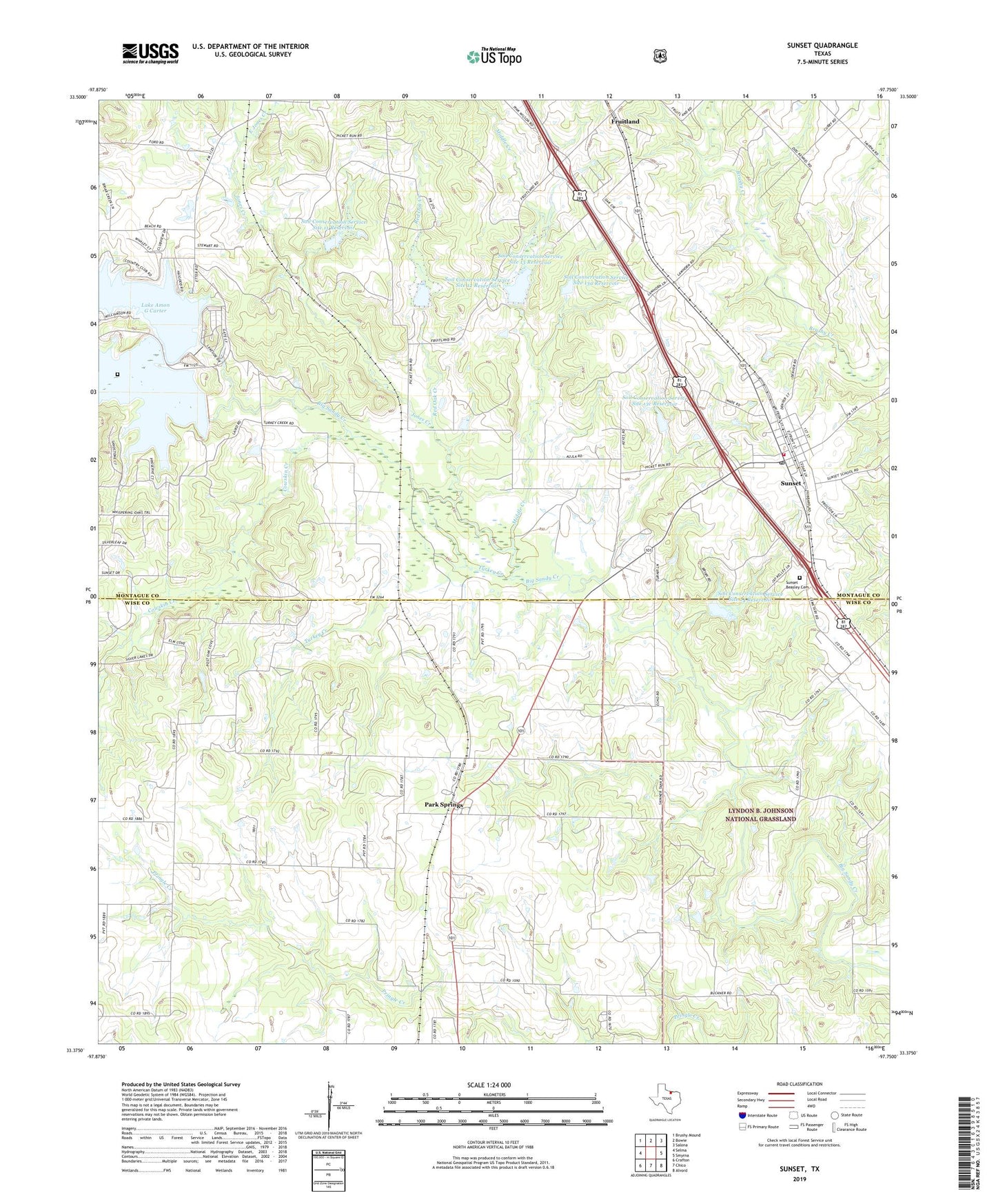
Sunset Texas US Topo Map
Couldn't load pickup availability
Also explore the Sunset Forest Service Topo of this same quad for updated USFS data
2022 topographic map quadrangle Sunset in the state of Texas. Scale: 1:24000. Based on the newly updated USGS 7.5' US Topo map series, this map is in the following counties: Montague, Wise. The map contains contour data, water features, and other items you are used to seeing on USGS maps, but also has updated roads and other features. This is the next generation of topographic maps. Printed on high-quality waterproof paper with UV fade-resistant inks.
Quads adjacent to this one:
West: Selma
Northwest: Brushy Mound
North: Bowie
Northeast: Salona
East: Smyrna
Southeast: Alvord
South: Chico
Southwest: Crafton
This map covers the same area as the classic USGS quad with code o33097d7.
Contains the following named places: Amon G Carter Dam, Big Sandy Creek Dam Number 11, Big Sandy Creek Dam Number 12, Big Sandy Creek Dam Number 13, Carter Lake Chapel, City of Sunset, Cowskin Creek, East Jones Creek, Jones Creek, Kiel Creek, Middle Creek, Park Springs, Red Oak Creek, Soil Conservation Service Site 11 Dam, Soil Conservation Service Site 11 Reservoir, Soil Conservation Service Site 12 Dam, Soil Conservation Service Site 12 Reservoir, Soil Conservation Service Site 13 Dam, Soil Conservation Service Site 13 Reservoir, Soil Conservation Service Site 13a Dam, Soil Conservation Service Site 13a Reservoir, Soil Conservation Service Site 13c Dam, Soil Conservation Service Site 13c Reservoir, Soil Conservation Service Site 14 Dam, Soil Conservation Service Site 14 Reservoir, Soil Conservation Service Site 8 Reservoir, Sunset, Sunset Beasley Cemetery, Sunset Census Designated Place, Sunset Post Office, Sunset Volunteer Fire Department, Tartar Cemetery, Turkey Creek, Victory Baptist Church, ZIP Code: 76270