MyTopo
Brady Mountain Texas US Topo Map
Couldn't load pickup availability
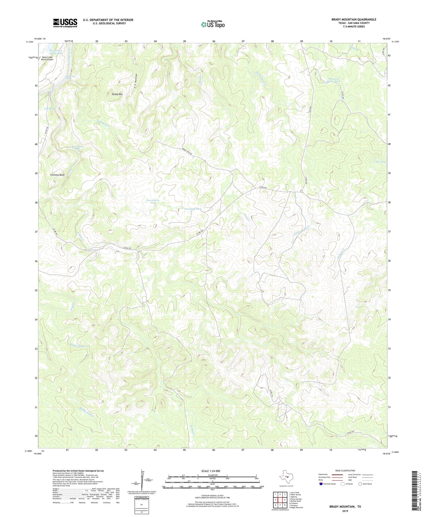
2019 topographic map quadrangle Brady Mountain in the state of Texas. Scale: 1:24000. Based on the newly updated USGS 7.5' US Topo map series, this map is in the following counties: San Saba. The map contains contour data, water features, and other items you are used to seeing on USGS maps, but also has updated roads and other features. This is the next generation of topographic maps. Printed on high-quality waterproof paper with UV fade-resistant inks.
Quads adjacent to this one:
West: Pecan Springs
Northwest: Lost Creek
North: Baker Spring
Northeast: Algerita
East: Buffalo Knob
Southeast: Magill Mountain
South: Pontotoc
Southwest: Fredonia
Contains the following named places: Bear Water Hole, Brady Mountain, Bull Trap Tank, Chimney Bluff, Click Tank, Cold Spring, Deep Creek, Deep Creek Spring, East Deep Creek, Flemming Tank, Hays Windmill, High Lonesome Windmill, High Windmill, Indian Hill Windmill, Larremore Tank, Little Windmill, Middle Deep Creek, Middle Pens Windmill, New Windmill, North Windmill, Pole Pen Ranch, Pool Ranch, Thousand Dollar Tank, West Deep Creek, Wild Boar Creek