MyTopo
Algerita Texas US Topo Map
Couldn't load pickup availability
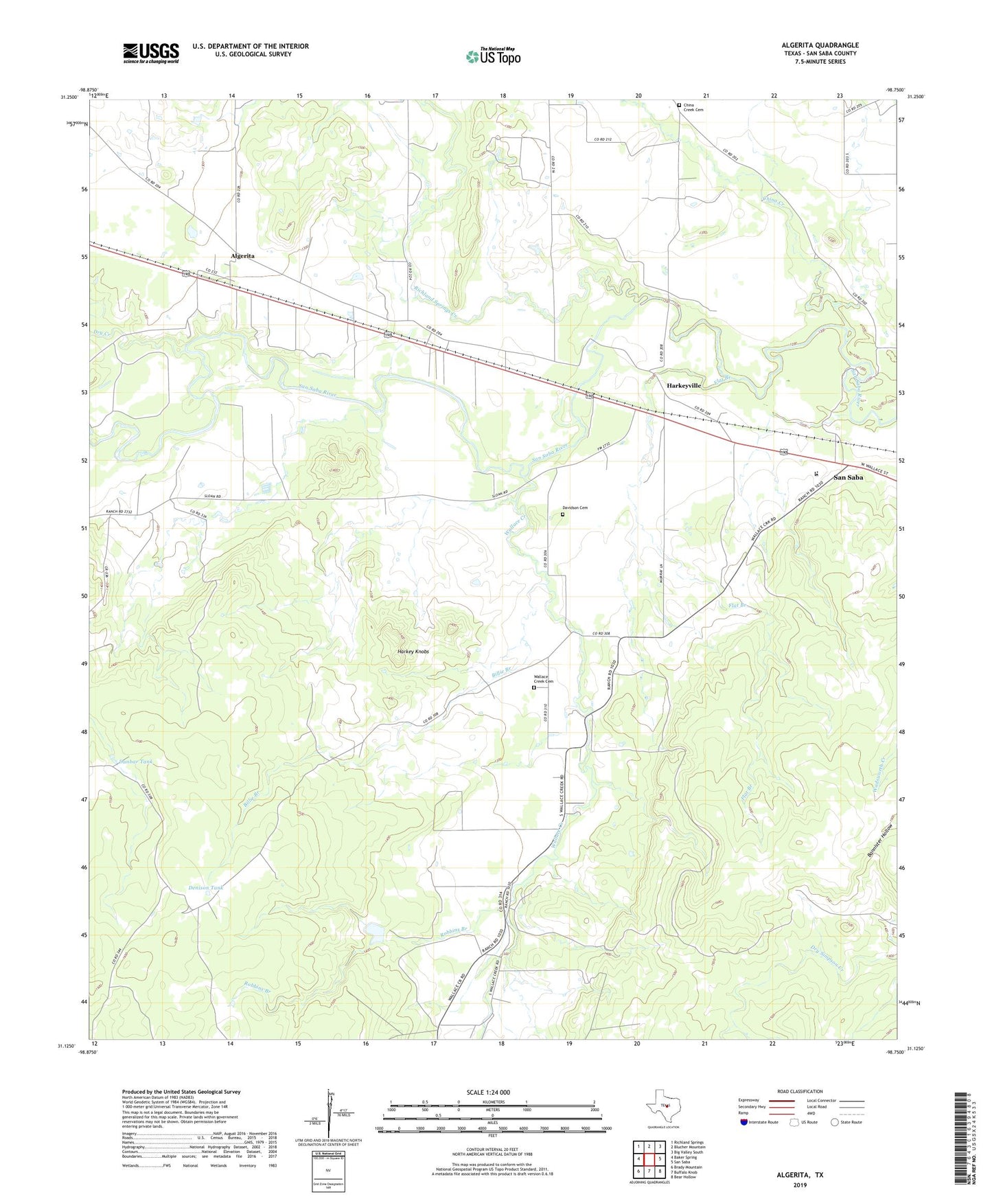
2022 topographic map quadrangle Algerita in the state of Texas. Scale: 1:24000. Based on the newly updated USGS 7.5' US Topo map series, this map is in the following counties: San Saba. The map contains contour data, water features, and other items you are used to seeing on USGS maps, but also has updated roads and other features. This is the next generation of topographic maps. Printed on high-quality waterproof paper with UV fade-resistant inks.
Quads adjacent to this one:
West: Baker Spring
Northwest: Richland Springs
North: Blucher Mountain
Northeast: Big Valley South
East: San Saba
Southeast: Bear Hollow
South: Buffalo Knob
Southwest: Brady Mountain
This map covers the same area as the classic USGS quad with code o31098b7.
Contains the following named places: Algerita, Billie Branch, China Creek, China Creek Cemetery, Davidson Cemetery, Denison Tank, Dry Creek, Dunbar Tank, Ellis Ranch, Flat Branch, Harkey Knobs, Harkeyville, Richland Springs Creek, Robbins Branch, San Saba County, Soil Conservation Service Site 15 Dam, Soil Conservation Service Site 15 Reservoir, Texas Department of Criminal Justice San Saba Transfer Facility, Wallace Creek, Wallace Creek Cemetery, Wallace Creek School, ZIP Code: 76877