MyTopo
Buffalo Knob Texas US Topo Map
Couldn't load pickup availability
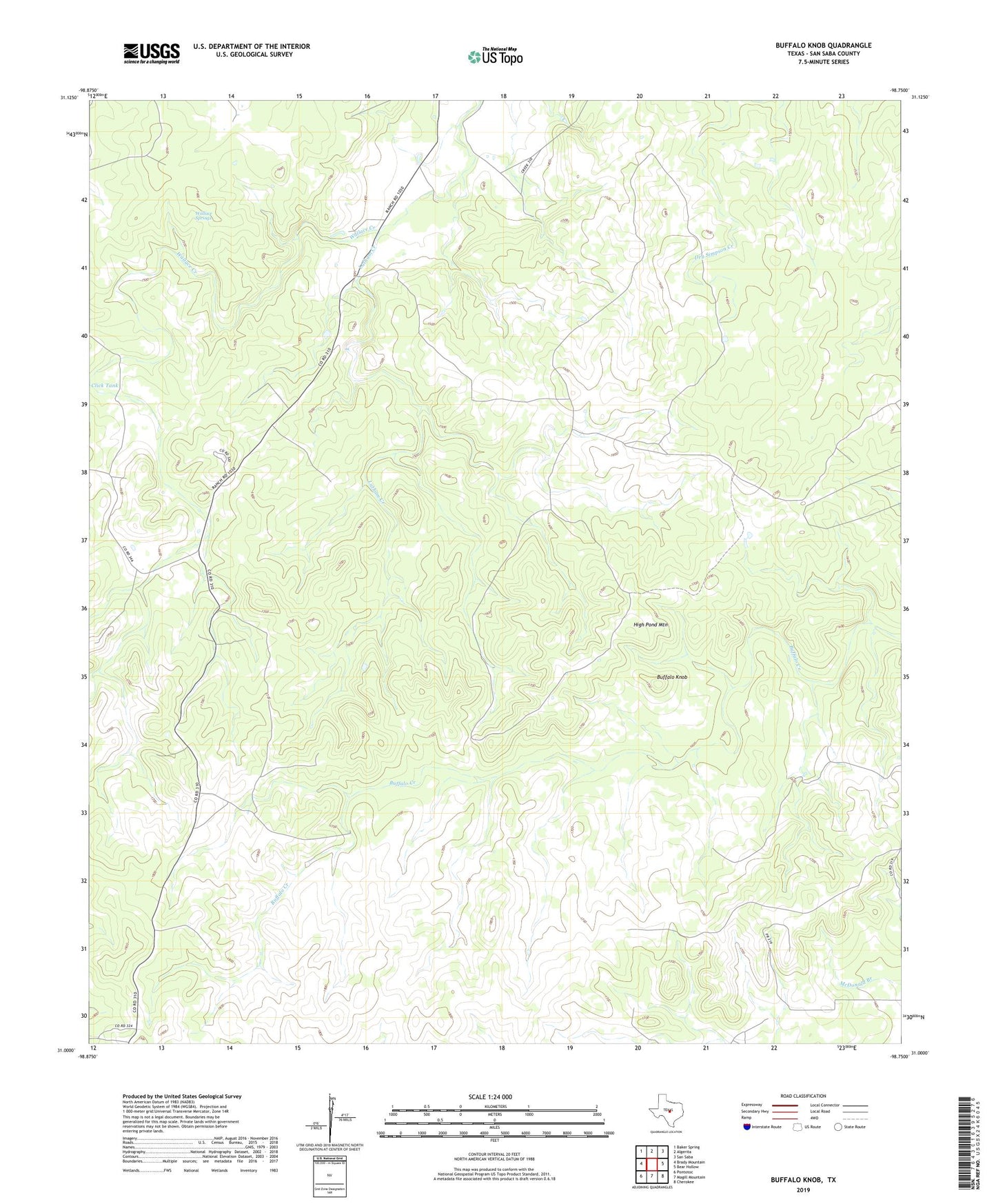
2022 topographic map quadrangle Buffalo Knob in the state of Texas. Scale: 1:24000. Based on the newly updated USGS 7.5' US Topo map series, this map is in the following counties: San Saba. The map contains contour data, water features, and other items you are used to seeing on USGS maps, but also has updated roads and other features. This is the next generation of topographic maps. Printed on high-quality waterproof paper with UV fade-resistant inks.
Quads adjacent to this one:
West: Brady Mountain
Northwest: Baker Spring
North: Algerita
Northeast: San Saba
East: Bear Hollow
Southeast: Cherokee
South: Magill Mountain
Southwest: Pontotoc
This map covers the same area as the classic USGS quad with code o31098a7.
Contains the following named places: Behmes Windmill, Buffalo Knob, Bull Trap Windmill, Dofflemyer Windmill, Flying V Windmill, High Pond Mountain, Kelley Windmill, Latham Creek, Nored Ranch, San Saba County Historical Museum, San Saba Division, Soil Conservation Service Site 13a Dam, Soil Conservation Service Site 13a Reservoir, Soil Conservation Service Site 14a Dam, Soil Conservation Service Site 14a Reservoir, Wallace Springs, Woodward Grove