MyTopo
Briscoe Texas US Topo Map
Couldn't load pickup availability
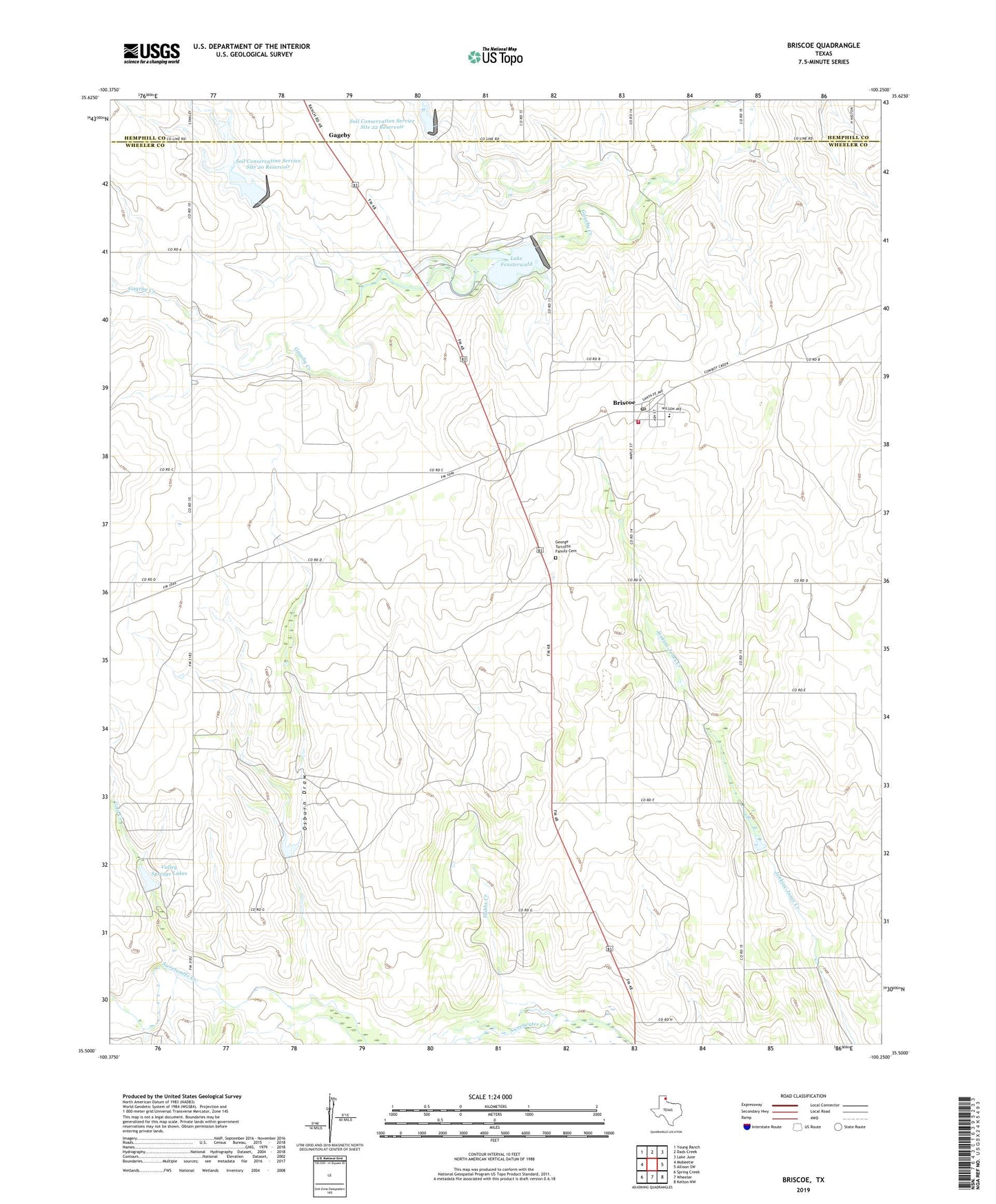
2022 topographic map quadrangle Briscoe in the state of Texas. Scale: 1:24000. Based on the newly updated USGS 7.5' US Topo map series, this map is in the following counties: Wheeler, Hemphill. The map contains contour data, water features, and other items you are used to seeing on USGS maps, but also has updated roads and other features. This is the next generation of topographic maps. Printed on high-quality waterproof paper with UV fade-resistant inks.
Quads adjacent to this one:
West: Mobeetie
Northwest: Young Ranch
North: Dads Creek
Northeast: Lake June
East: Allison SW
Southeast: Kelton NW
South: Wheeler
Southwest: Spring Creek
This map covers the same area as the classic USGS quad with code o35100e3.
Contains the following named places: Briscoe, Briscoe Post Office, Briscoe Volunteer Fire Department Station 1, Cold Creek, Dam Number 20, Dam Number 21, Dam Number 22, Dubbs Creek, Fort Elliott Cougar Field, Gageby, George Turcotte Family Cemetery, Lake Fensterwald, Osburn Draw, Soil Conservation Service Site 20 Dam, Soil Conservation Service Site 20 Reservoir, Soil Conservation Service Site 21 Dam, Soil Conservation Service Site 21 Reservoir, Soil Conservation Service Site 22 Dam, Soil Conservation Service Site 22 Reservoir, Valley Springs Lakes