MyTopo
Mobeetie Texas US Topo Map
Couldn't load pickup availability
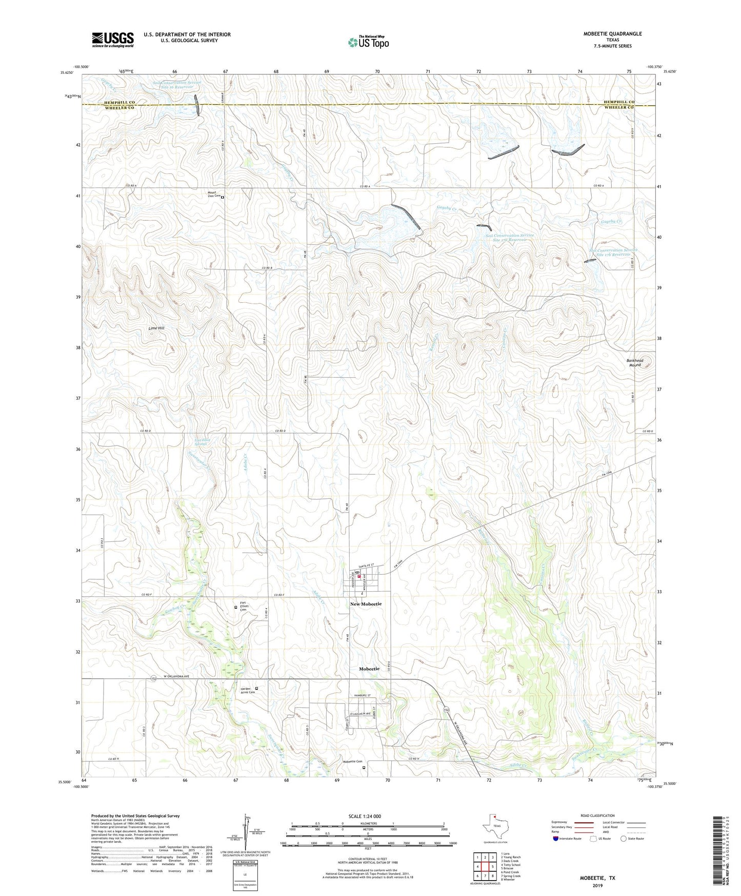
2022 topographic map quadrangle Mobeetie in the state of Texas. Scale: 1:24000. Based on the newly updated USGS 7.5' US Topo map series, this map is in the following counties: Wheeler, Hemphill. The map contains contour data, water features, and other items you are used to seeing on USGS maps, but also has updated roads and other features. This is the next generation of topographic maps. Printed on high-quality waterproof paper with UV fade-resistant inks.
Quads adjacent to this one:
West: Totty School
Northwest: Lora
North: Young Ranch
Northeast: Dads Creek
East: Briscoe
Southeast: Wheeler
South: Spring Creek
Southwest: Pond Creek
This map covers the same area as the classic USGS quad with code o35100e4.
Contains the following named places: Bankhead Mound, Carwile Ranch, Cassino Creek, City of Mobeetie, Cowboy Creek, Dam Number 16, Dam Number 17, Dam Number 17A, Dam Number 17B, Dam Number 18, Dam Number 19, Fort Elliot, Fort Elliot Springs, Fort Elliott Cemetery, Harden Acres Cemetery, Lime Hill, Mobeetie, Mobeetie Cemetery, Mobeetie Jail Museum, Mobeetie Post Office, Mobeetie Volunteer Fire Department, Mount Zion Cemetery, New Mobeetie, Russell Creek, Soil Conservation Service Site 16 Dam, Soil Conservation Service Site 16 Reservoir, Soil Conservation Service Site 17 Dam, Soil Conservation Service Site 17 Reservoir, Soil Conservation Service Site 17a Dam, Soil Conservation Service Site 17a Reservoir, Soil Conservation Service Site 17b Dam, Soil Conservation Service Site 17b Reservoir, Soil Conservation Service Site 18 Dam, Soil Conservation Service Site 18 Reservoir, Soil Conservation Service Site 19 Dam, Soil Conservation Service Site 19 Reservoir, ZIP Code: 79061