MyTopo
Brushy Creek Texas US Topo Map
Couldn't load pickup availability
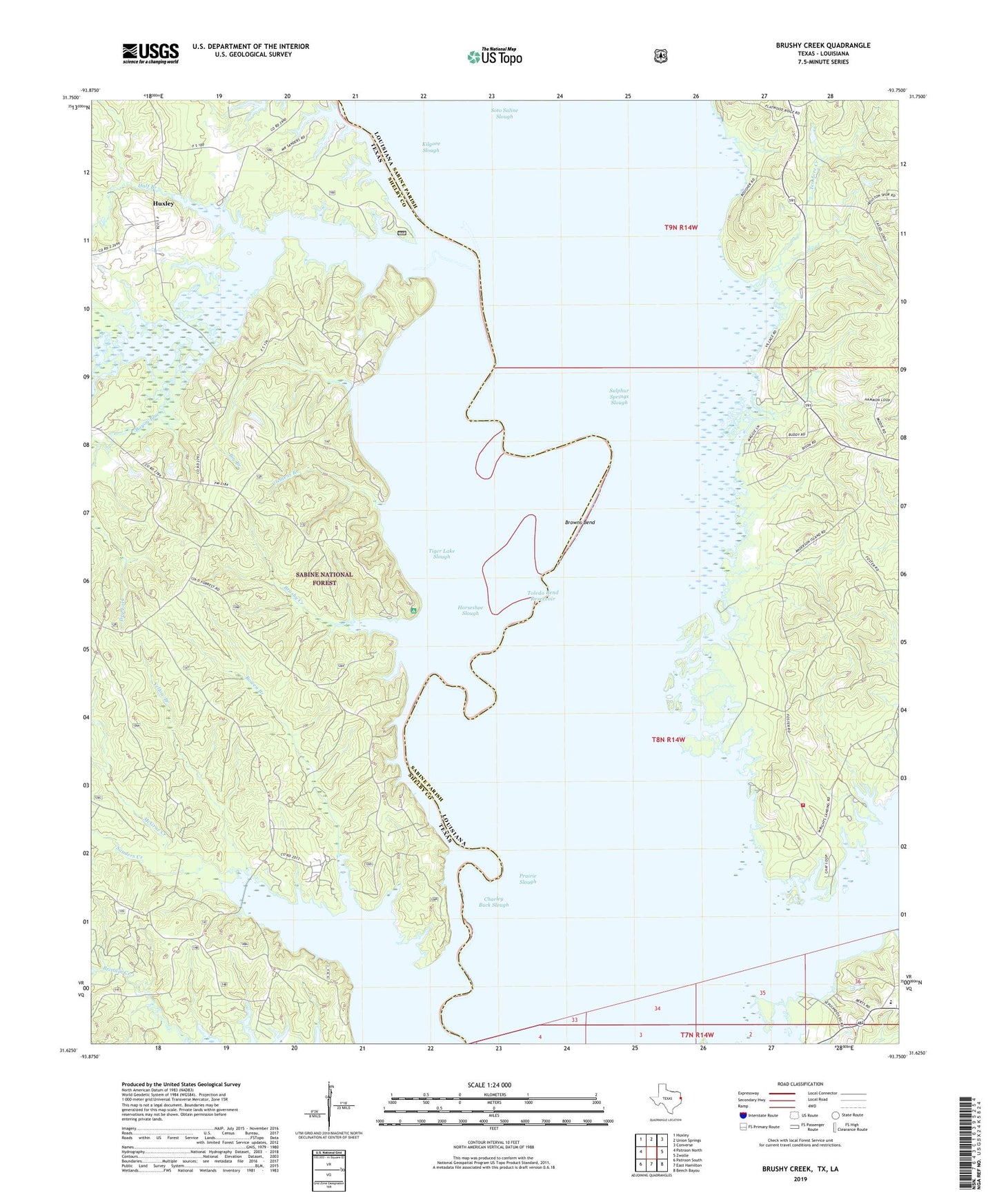
2019 topographic map quadrangle Brushy Creek in the states of Louisiana, Texas. Scale: 1:24000. Based on the newly updated USGS 7.5' US Topo map series, this map is in the following counties: Shelby, Sabine. The map contains contour data, water features, and other items you are used to seeing on USGS maps, but also has updated roads and other features. This is the next generation of topographic maps. Printed on high-quality waterproof paper with UV fade-resistant inks.
Quads adjacent to this one:
West: Patroon North
Northwest: Huxley
North: Union Springs
Northeast: Converse
East: Zwolle
Southeast: Beech Bayou
South: East Hamilton
Southwest: Patroon South
Contains the following named places: Bayou Blue, Big Branch, Bowen Branch, Brown School, Browns Bend, Brushy Creek, Buzzard Bend, Charley Buck Slough, Clemens Branch, Ebarb, Ebarb High School, Haley Ferry, Half Branch, Horseshoe Slough, Jones Old River, Kilgore Slough, McGrue Creek, North Sabine Fire Protection District Hotwell Station, Parish Governing Authority District 7, Pleasant Hill Church, Prairie Slough, Ragtown Recreation Site, Round Lake, Round Lake Swamp, Saline Lake, San Patricio Lake, Sanders Creek, Silvie Bend, Snyders Boat Ramp, Soto Saline Slough, Sulphur Springs Slough, Ten Acre Creek, Tiger Lake Slough, West Hamilton Church, Yellow Branch