MyTopo
Converse Louisiana US Topo Map
Couldn't load pickup availability
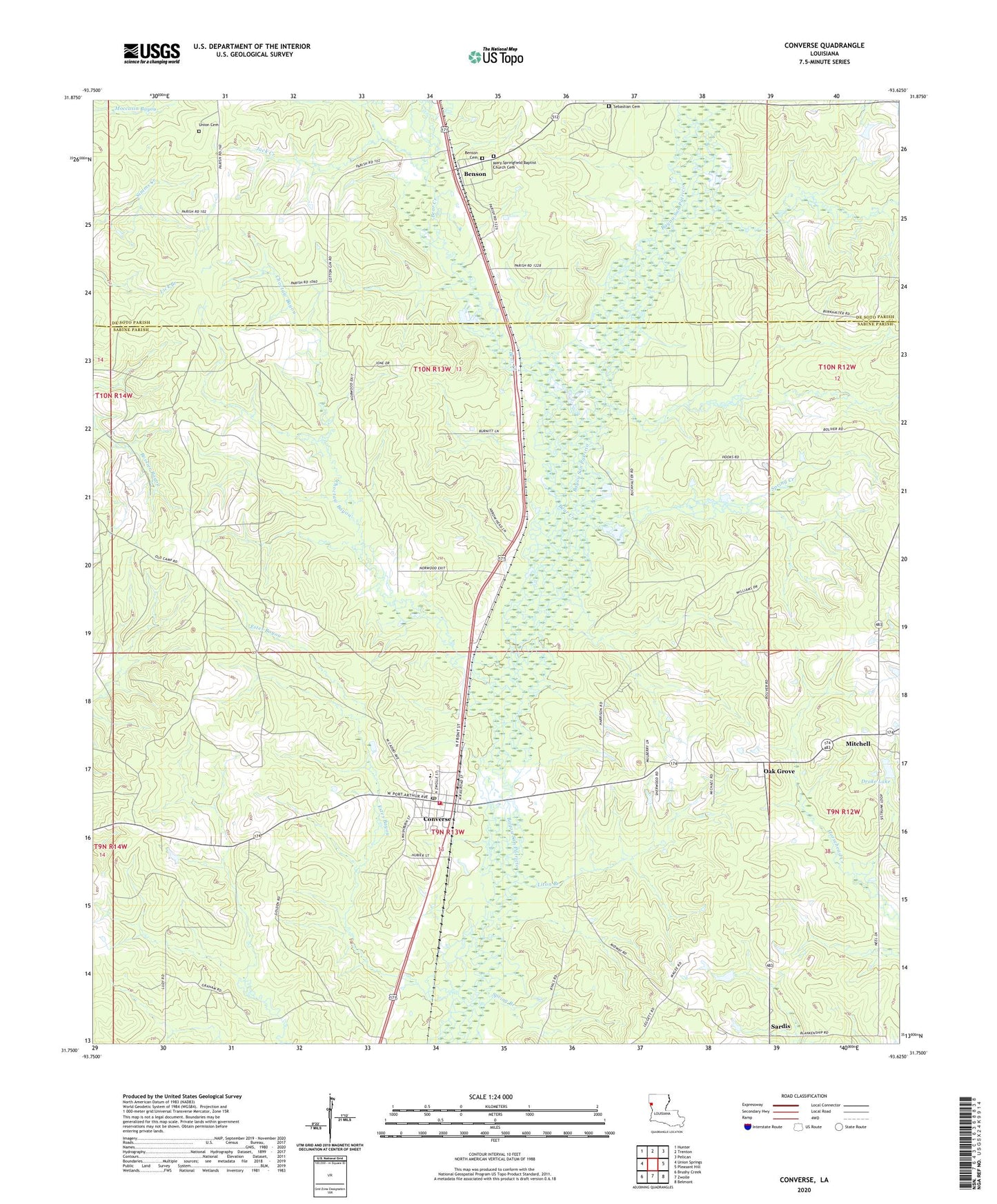
2024 topographic map quadrangle Converse in the state of Louisiana. Scale: 1:24000. Based on the newly updated USGS 7.5' US Topo map series, this map is in the following counties: Sabine, De Soto. The map contains contour data, water features, and other items you are used to seeing on USGS maps, but also has updated roads and other features. This is the next generation of topographic maps. Printed on high-quality waterproof paper with UV fade-resistant inks.
Quads adjacent to this one:
West: Union Springs
Northwest: Hunter
North: Trenton
Northeast: Pelican
East: Pleasant Hill
Southeast: Belmont
South: Zwolle
Southwest: Brushy Creek
This map covers the same area as the classic USGS quad with code o31093g6.
Contains the following named places: Bear Creek, Benson, Benson Oil and Gas Field, Choctaw Bayou, Converse, Converse High School, Converse Oil and Gas Field, Converse Post Office, Drake Lake, Estes Bayou, Jack Creek, Las Ormigas Grant, Liton Branch, Mitchell, Mitchell School, North Sabine Fire Protection District Converse Station, Oak Grove, Oak Grove High School, Old Union Church, Pleasant Hill Oil and Gas Field, Saint Peter Church of God in Christ, Sardis, Sebastian Cemetery, Spring Branch, Spring Creek, Spring Creek School, United Church, Village of Converse, Ward Six, Ward Ten, ZIP Code: 71419