MyTopo
Zwolle Louisiana US Topo Map
Couldn't load pickup availability
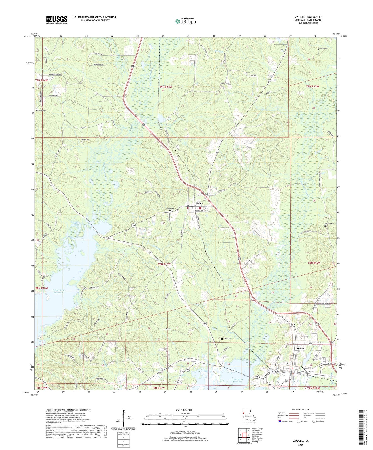
2024 topographic map quadrangle Zwolle in the state of Louisiana. Scale: 1:24000. Based on the newly updated USGS 7.5' US Topo map series, this map is in the following counties: Sabine. The map contains contour data, water features, and other items you are used to seeing on USGS maps, but also has updated roads and other features. This is the next generation of topographic maps. Printed on high-quality waterproof paper with UV fade-resistant inks.
Quads adjacent to this one:
West: Brushy Creek
Northwest: Union Springs
North: Converse
Northeast: Pleasant Hill
East: Belmont
Southeast: Loring
South: Beech Bayou
Southwest: East Hamilton
This map covers the same area as the classic USGS quad with code o31093f6.
Contains the following named places: Bapsilene School, Brown Cemetery, Cassel Cemetery, Clyde, Clyde Cemetery, Clyde School, Derby Branch, Ebarb School Oil and Gas Field, First Baptist Church, Noble, Noble Cemetery, Noble Post Office, North Sabine Fire Protection District Noble Station 1, North Sabine Fire Protection District Noble Station 2, North Sabine Volunteer Fire Protection District, Parrott Cemetery, Saint Josephs Catholic Church, Saline Church, Saline Industrial Institute, San Patricio Church, Sardis Cemetery, Sardis Church, Shiloh Cemetery, Shiloh Church, Town of Zwolle, Village of Noble, Ward Eight, Zwolle, Zwolle Elementary School, Zwolle High School, Zwolle Intermediate School, Zwolle Police Department, ZIP Code: 71462