MyTopo
Silver Lake Texas US Topo Map
Couldn't load pickup availability
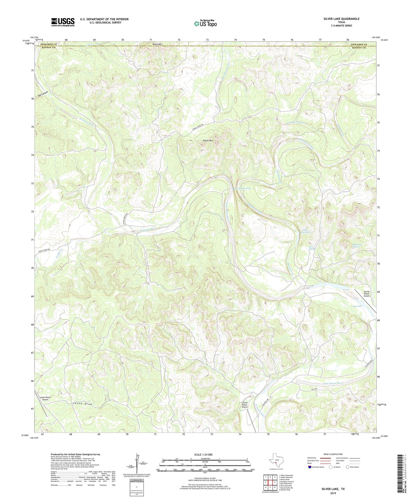
2022 topographic map quadrangle Silver Lake in the state of Texas. Scale: 1:24000. Based on the newly updated USGS 7.5' US Topo map series, this map is in the following counties: Kinney, Edwards. The map contains contour data, water features, and other items you are used to seeing on USGS maps, but also has updated roads and other features. This is the next generation of topographic maps. Printed on high-quality waterproof paper with UV fade-resistant inks.
Quads adjacent to this one:
West: Kickapoo Caverns
Northwest: Wiley Waterhole
North: Indian Mountain
Northeast: Kelley Peak
East: Bull Waterhole
Southeast: Salmon Peak
South: Brackettville NE
Southwest: Pinto Mountain
This map covers the same area as the classic USGS quad with code o29100e3.
Contains the following named places: Back Porch Ranch Airport, Big Canyon, Black Mountain, Blue Waterhole, De Long Ranch Airport, Dry Sycamore Creek, Dutch Mountain, Dutch Waterhole, Griffin Creek, L Davis Ranch Airport, Leona Ranch Airport, Long Lake, Schwander Springs, Silver Lake, Silver Lake Ranch, Silver Springs, Spring Branch, Spring Ranch Airport, Sycamore Creek