MyTopo
Burro Canyon Texas US Topo Map
Couldn't load pickup availability
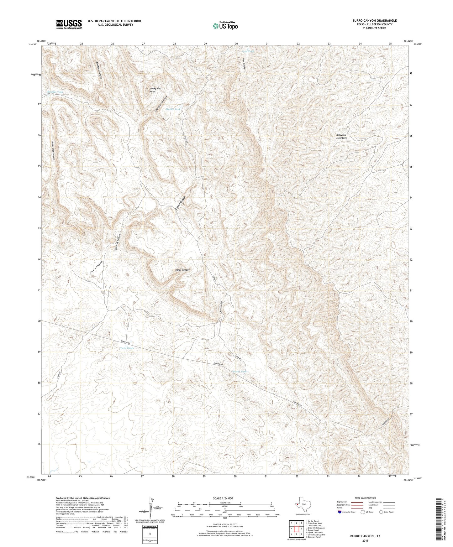
2019 topographic map quadrangle Burro Canyon in the state of Texas. Scale: 1:24000. Based on the newly updated USGS 7.5' US Topo map series, this map is in the following counties: Culberson. The map contains contour data, water features, and other items you are used to seeing on USGS maps, but also has updated roads and other features. This is the next generation of topographic maps. Printed on high-quality waterproof paper with UV fade-resistant inks.
Quads adjacent to this one:
West: Bitter Well Mountain
Northwest: Six Bar Ranch
North: Chico Draw West
Northeast: Chico Draw East
East: Emory Corral
Southeast: Delaware Ranch
South: Seven Heart Gap NW
Southwest: Figure Two Ranch
Contains the following named places: Apache Tank, Bitter Well Canyon, Boulder Tank, Burro Canyon, Cistern Canyon, Codorniz Canyon, Cooky Hat Point, Delaware Mountains, Janes Window, Leed Tank, Little Codorniz Canyon, Middle Tank, Nester Tank, No Mans Canyon, Pezuna del Caballo, Posey Well, Roberts Camp, Twin Tanks