MyTopo
Emory Corral Texas US Topo Map
Couldn't load pickup availability
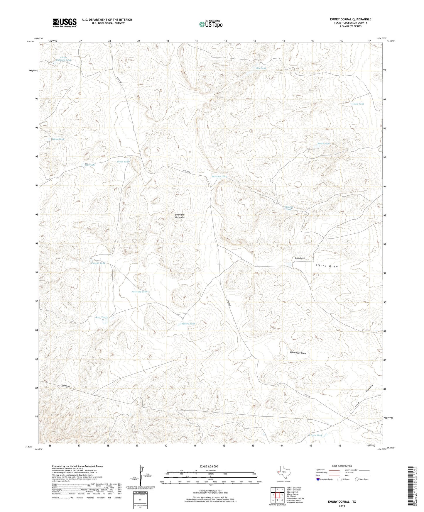
2022 topographic map quadrangle Emory Corral in the state of Texas. Scale: 1:24000. Based on the newly updated USGS 7.5' US Topo map series, this map is in the following counties: Culberson. The map contains contour data, water features, and other items you are used to seeing on USGS maps, but also has updated roads and other features. This is the next generation of topographic maps. Printed on high-quality waterproof paper with UV fade-resistant inks.
Quads adjacent to this one:
West: Burro Canyon
Northwest: Chico Draw West
North: Chico Draw East
Northeast: Seven L Peak
East: K C Ranch
Southeast: Loneman Mountain
South: Delaware Ranch
Southwest: Seven Heart Gap NW
This map covers the same area as the classic USGS quad with code o31104e5.
Contains the following named places: Antelope Tank, Barstow Tank, Big Tank, Broke Tank, Cargile Tank, Carr Tanks, Dog Tank, Emory Corral, Emory Draw, Frijole Tank, JD Tank, Lower Calhoun Tank, Pecos Tank, Sifford Tank, Stevens Tank, White Tank