MyTopo
Butler Texas US Topo Map
Couldn't load pickup availability
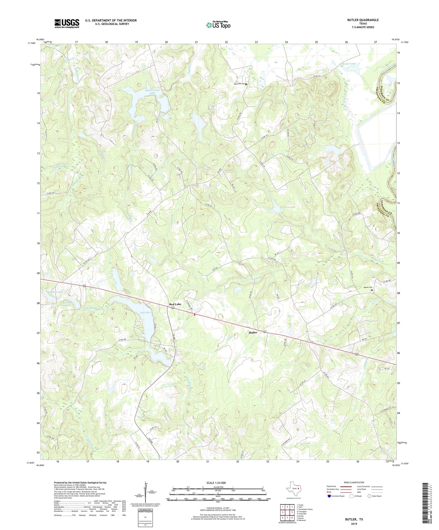
2019 topographic map quadrangle Butler in the state of Texas. Scale: 1:24000. Based on the newly updated USGS 7.5' US Topo map series, this map is in the following counties: Freestone, Anderson. The map contains contour data, water features, and other items you are used to seeing on USGS maps, but also has updated roads and other features. This is the next generation of topographic maps. Printed on high-quality waterproof paper with UV fade-resistant inks.
Quads adjacent to this one:
West: Turlington
Northwest: Young
North: Yard
Northeast: Tennessee Colony
East: Long Lake
Southeast: Oakwood
South: Keechi
Southwest: Lanely
Contains the following named places: Alum Branch, Batsmith Creek, Brinkley Creek, Burleson Lake, Burleson Lake Dam, Butler, Butler Division, Butler High School, Butler Volunteer Fire Department, Daniel Memorial Childrens Home, Evans Lake, Harding Lake, Harding Lake Dam, Indian Creek Lake, Indian Creek Lake Dam, Jerusalem Church, Little Red Lake, Little Red Lake Dam, Mayes Cemetery, Owens Chapel, Pearson Lake, Pearson Lake Dam, Pilgrim Rest Church, Pine Hill Church, Pine Top Church, Red Lake, Red Lake Dam, Red Lake Number 3, Red Lake Number 3 Dam, Sand Hill, Sand Hill Cemetery, Sand Hill Church, Shiloh Church, Waymon Chapel, Willow Creek