MyTopo
Yard Texas US Topo Map
Couldn't load pickup availability
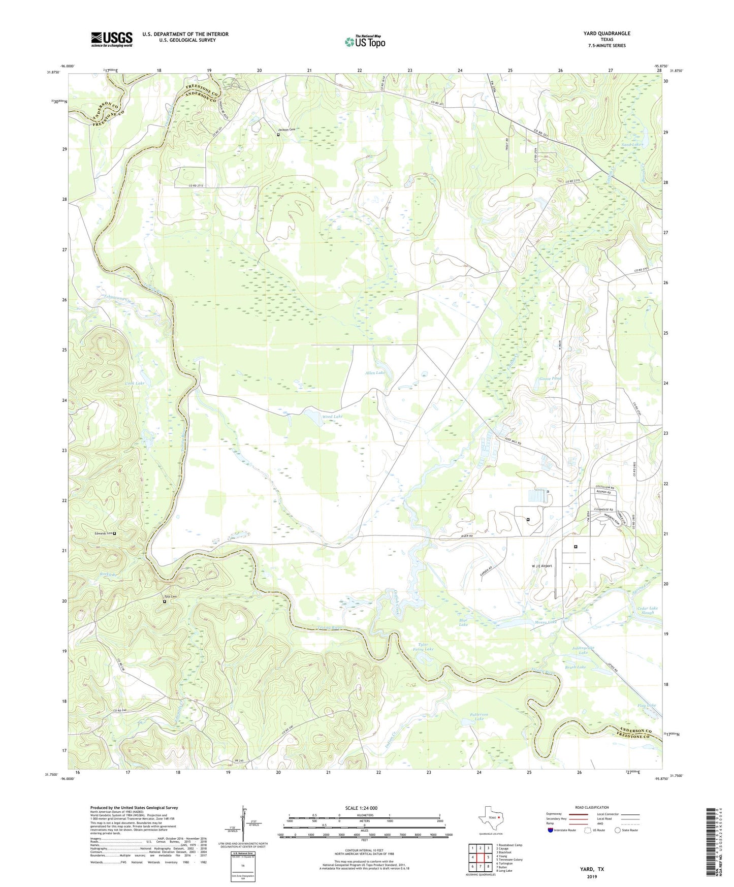
2022 topographic map quadrangle Yard in the state of Texas. Scale: 1:24000. Based on the newly updated USGS 7.5' US Topo map series, this map is in the following counties: Anderson, Freestone. The map contains contour data, water features, and other items you are used to seeing on USGS maps, but also has updated roads and other features. This is the next generation of topographic maps. Printed on high-quality waterproof paper with UV fade-resistant inks.
Quads adjacent to this one:
West: Young
Northwest: Roustabout Camp
North: Cayuga
Northeast: Blackfoot
East: Tennessee Colony
Southeast: Long Lake
South: Butler
Southwest: Turlington
This map covers the same area as the classic USGS quad with code o31095g8.
Contains the following named places: Allen Lake, Alligator Slough, Bear Lake, Beaver Creek, Blue Lake, Brush Lake, Campbell Lake, Catfish Creek, Cold Springs Branch, Cook Lake, Edwards Cemetery, Edwards Creek, Flag Lake, Goose Pond, Greens Bluff, Indian Creek, Jackson Cemetery, Johnnycake Lake, McFarlen Lake, Mossy Lake, Mount Olive Church, New Hope Church, Patterson Lake, Peters Lake, Prairie Lake, Rocky Branch, Sand Lake, Spring Creek, Tehuacana Creek, Texas Department of Criminal Justice H H Coffield Unit, Texas Department of Criminal Justice Mark W Michael Unit, Trinity Chapel School, Tyler Ferry Lake, Tyus Cemetery, W J E Airport, Weed Lake, Yard, Yard School, ZIP Code: 75861