MyTopo
Camp Springs Texas US Topo Map
Couldn't load pickup availability
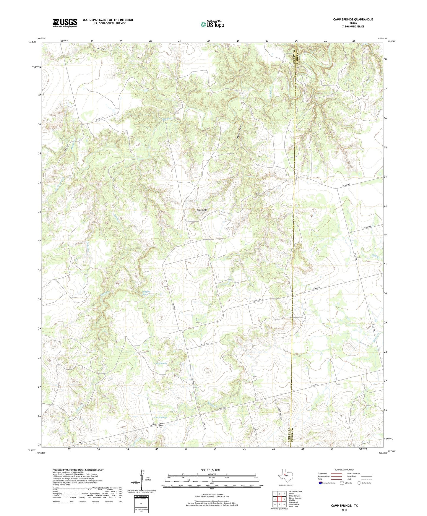
2022 topographic map quadrangle Camp Springs in the state of Texas. Scale: 1:24000. Based on the newly updated USGS 7.5' US Topo map series, this map is in the following counties: Scurry, Fisher. The map contains contour data, water features, and other items you are used to seeing on USGS maps, but also has updated roads and other features. This is the next generation of topographic maps. Printed on high-quality waterproof paper with UV fade-resistant inks.
Quads adjacent to this one:
West: Lloyd Mountain
Northwest: Maverick Creek
North: Hudd
Northeast: Tige Canyon
East: Hobbs
Southeast: Bull Creek
South: Inadale NW
Southwest: Hermleigh
This map covers the same area as the classic USGS quad with code o32100g6.
Contains the following named places: Camp Creek, Camp Springs, Camp Springs Cemetery, Cottonwood Creek, Dripping Spring, Green Mountain, Gyp Draw, Horse Hollow, Turkey Creek