MyTopo
Hudd Texas US Topo Map
Couldn't load pickup availability
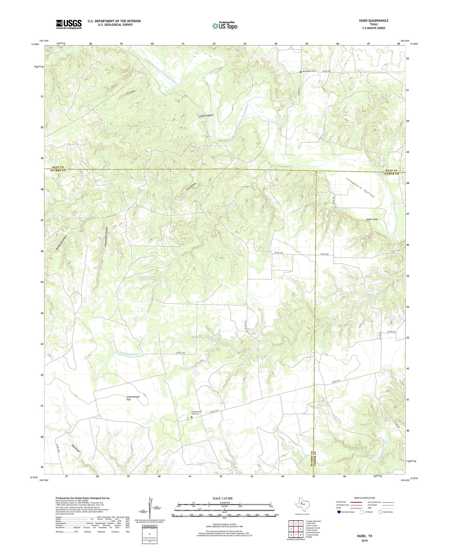
2022 topographic map quadrangle Hudd in the state of Texas. Scale: 1:24000. Based on the newly updated USGS 7.5' US Topo map series, this map is in the following counties: Scurry, Kent, Fisher. The map contains contour data, water features, and other items you are used to seeing on USGS maps, but also has updated roads and other features. This is the next generation of topographic maps. Printed on high-quality waterproof paper with UV fade-resistant inks.
Quads adjacent to this one:
West: Maverick Creek
Northwest: Cooper Mountain
North: Gant Hills
Northeast: A B C Creek
East: Tige Canyon
Southeast: Hobbs
South: Camp Springs
Southwest: Lloyd Mountain
This map covers the same area as the classic USGS quad with code o32100h6.
Contains the following named places: Big Gobbler, Cottonwood Flat, Cottonwood Flat Cemetery, Cox Hollow, Criswell Ranch, Goldstens Branch, Hudd, Impossible Canyon, Little Gobbler, Red Aleck Canyon, Riverdale Cemetery, Sugar Loaf