MyTopo
Campo Grande Mountain Texas US Topo Map
Couldn't load pickup availability
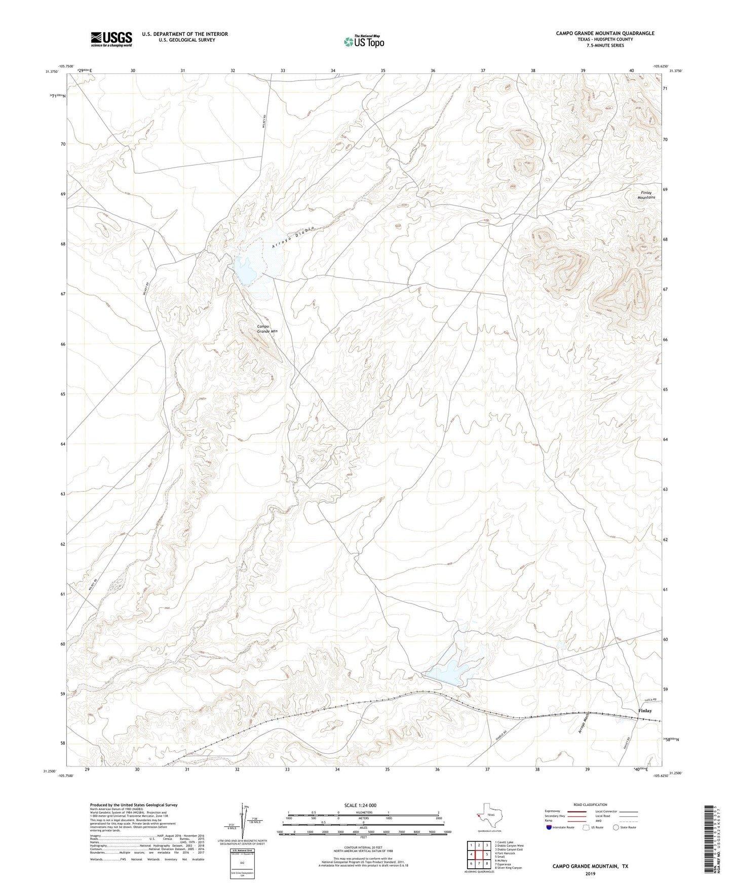
2022 topographic map quadrangle Campo Grande Mountain in the state of Texas. Scale: 1:24000. Based on the newly updated USGS 7.5' US Topo map series, this map is in the following counties: Hudspeth. The map contains contour data, water features, and other items you are used to seeing on USGS maps, but also has updated roads and other features. This is the next generation of topographic maps. Printed on high-quality waterproof paper with UV fade-resistant inks.
Quads adjacent to this one:
West: Fort Hancock
Northwest: Cavett Lake
North: Diablo Canyon West
Northeast: Diablo Canyon East
East: Small
Southeast: Silver King Canyon
South: Esperanza
Southwest: McNary
This map covers the same area as the classic USGS quad with code o31105c6.
Contains the following named places: Campo Grande Mountain, Diablo Reservoir Number One, Finlay, Madden Reservoir, Soil Conservation Service Site 1 Dam