MyTopo
Capote Falls Texas US Topo Map
Couldn't load pickup availability
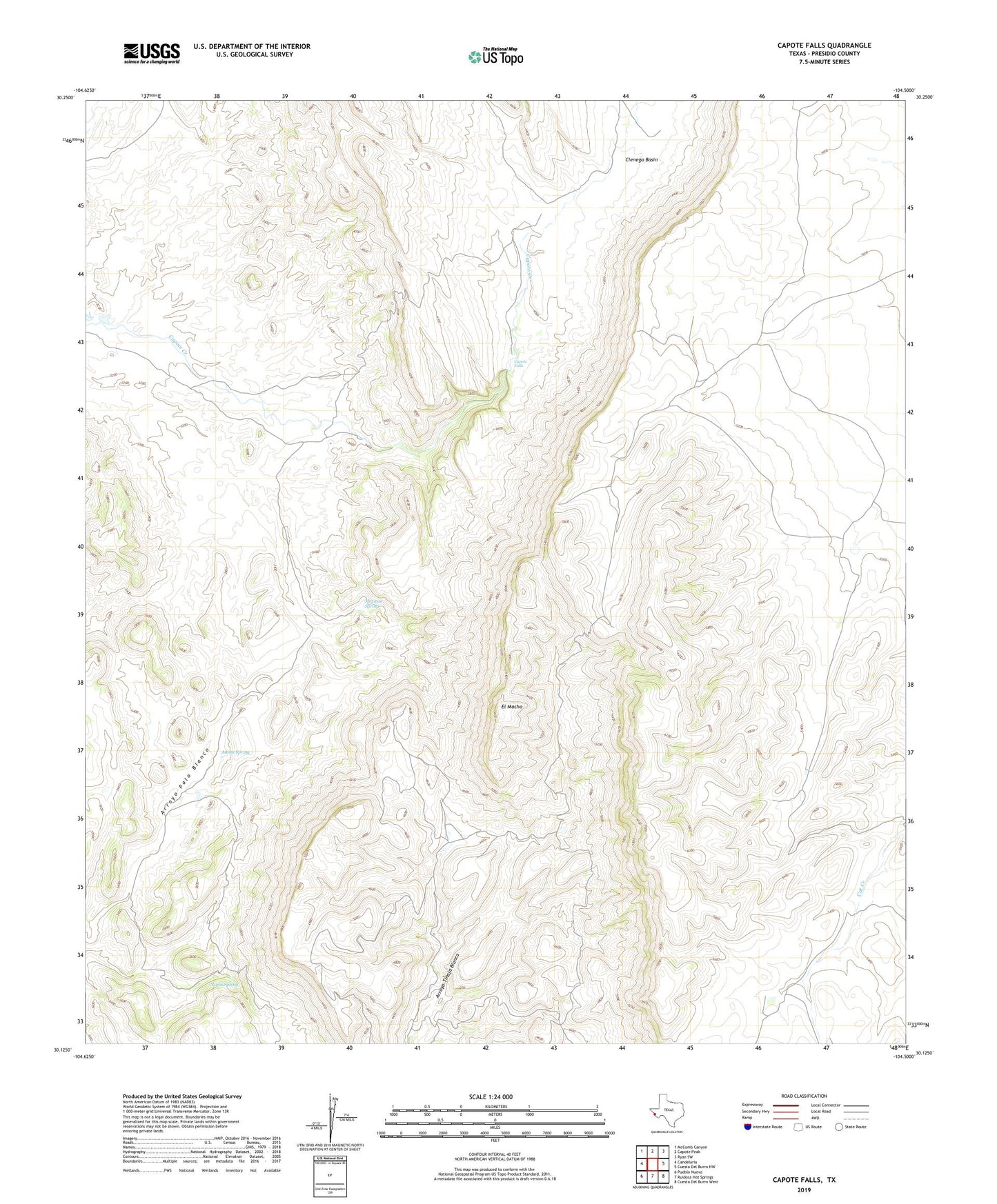
2022 topographic map quadrangle Capote Falls in the state of Texas. Scale: 1:24000. Based on the newly updated USGS 7.5' US Topo map series, this map is in the following counties: Presidio. The map contains contour data, water features, and other items you are used to seeing on USGS maps, but also has updated roads and other features. This is the next generation of topographic maps. Printed on high-quality waterproof paper with UV fade-resistant inks.
Quads adjacent to this one:
West: Candelaria
Northwest: McComb Canyon
North: Capote Peak
Northeast: Ryan SW
East: Cuesta Del Burro NW
Southeast: Cuesta Del Burro West
South: Ruidosa Hot Springs
Southwest: Pueblo Nuevo
This map covers the same area as the classic USGS quad with code o30104b5.
Contains the following named places: Adobe Spring, Capote Falls, Capote Ranch, Cienega Basin, Clenega Windmill, El Macho, High Lonesome Windmill, Little Shannon Windmill, Long Hollow Windmill, Mexican Spring, Nixon Spring