MyTopo
Pueblo Nuevo Texas US Topo Map
Couldn't load pickup availability
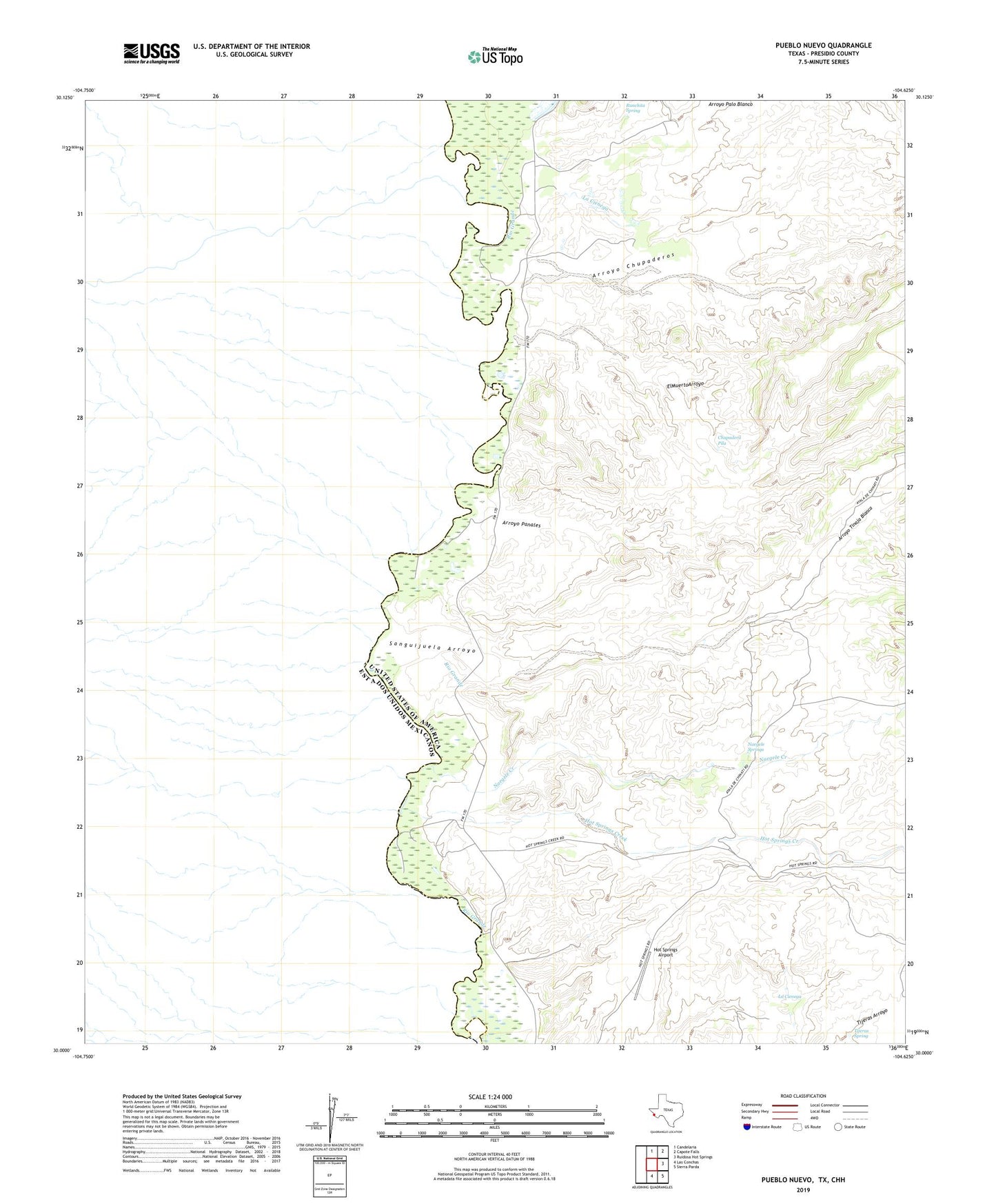
2022 topographic map quadrangle Pueblo Nuevo in the state of Texas. Scale: 1:24000. Based on the newly updated USGS 7.5' US Topo map series, this map is in the following counties: Presidio. The map contains contour data, water features, and other items you are used to seeing on USGS maps, but also has updated roads and other features. This is the next generation of topographic maps. Printed on high-quality waterproof paper with UV fade-resistant inks.
Quads adjacent to this one:
North: Candelaria
Northeast: Capote Falls
East: Ruidosa Hot Springs
Southeast: Sierra Parda
South: Las Conchas
This map covers the same area as the classic USGS quad with code o30104a6.
Contains the following named places: Arroyo Chupaderos, Arroyo Palo Blanco, Arroyo Panales, Arroyo Tinaja Blanca, Chupadera Pila, El Muerto Arroyo, Hot Springs Airport, Hot Springs Creek, La Cienega, Las Lulas, Las Palomas Wildlife Management Area - Ocotillo Unit, Naegele Creek, Naegele Springs, Prietos Bar, Pueblo Nuevo, Ranchita Spring, Sanguijuela Arroyo, Tijeras Spring