MyTopo
Carbon Texas US Topo Map
Couldn't load pickup availability
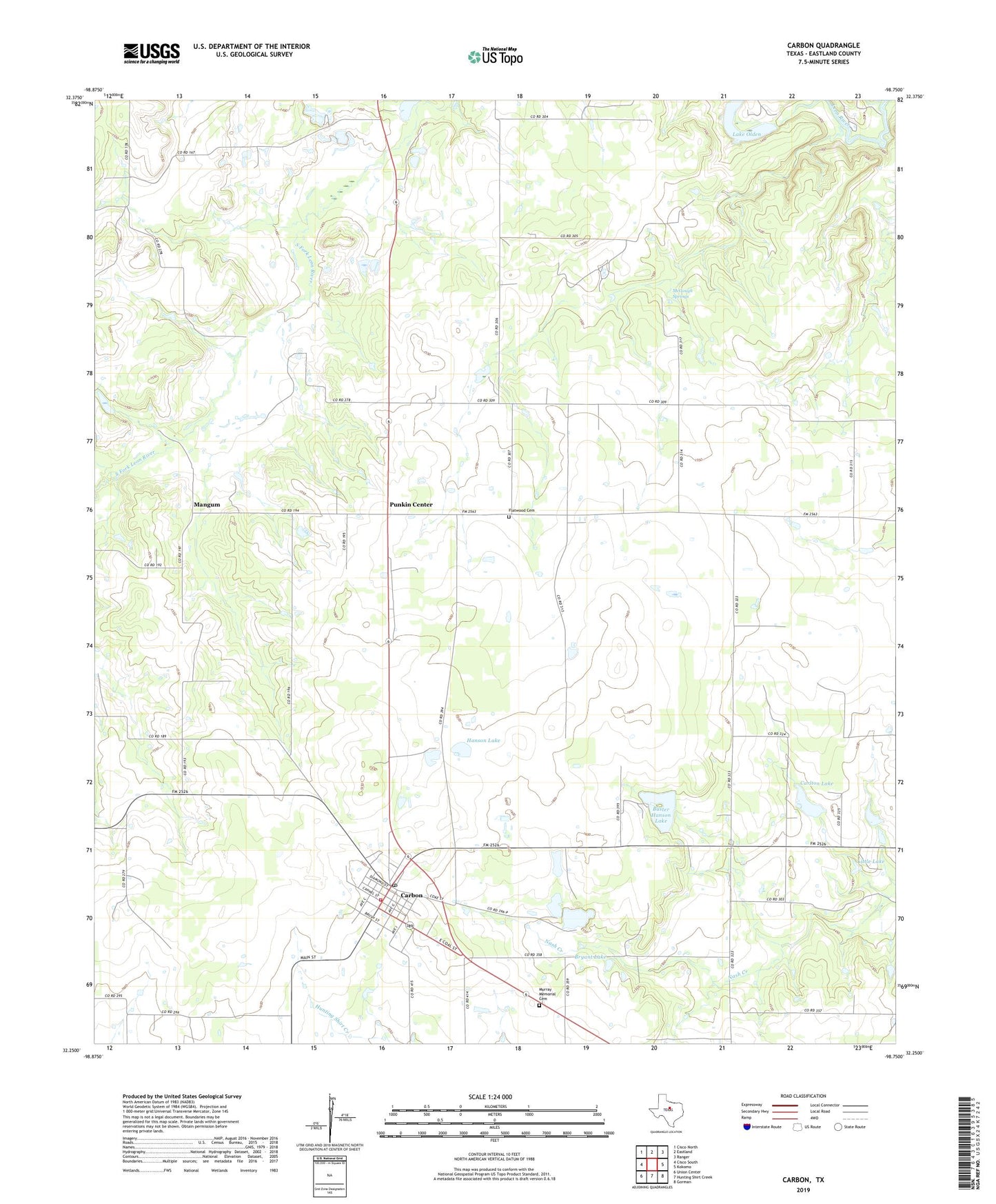
2019 topographic map quadrangle Carbon in the state of Texas. Scale: 1:24000. Based on the newly updated USGS 7.5' US Topo map series, this map is in the following counties: Eastland. The map contains contour data, water features, and other items you are used to seeing on USGS maps, but also has updated roads and other features. This is the next generation of topographic maps. Printed on high-quality waterproof paper with UV fade-resistant inks.
Quads adjacent to this one:
West: Cisco South
Northwest: Cisco North
North: Eastland
Northeast: Ranger
East: Kokomo
Southeast: Gorman
South: Hunting Shirt Creek
Southwest: Union Center
Contains the following named places: Bryant Dam, Bryant Lake, Buster Hanson Lake, Buster Hanson Lake Dam, Carbon, Carbon City Hall, Carbon Post Office, Carbon Volunteer Fire Department, Carlton Dam, Carlton Lake, Eastland County, Flatwood Cemetery, Hanson Dam, Hanson Lake, Lake Olden, Lake Olden Dam, Leon Powerplant, Little Lake, Little Lake Dam, Mangum, McGough Springs, Murray Memorial Cemetery, Punkin Center, Town of Carbon