MyTopo
Kokomo Texas US Topo Map
Couldn't load pickup availability
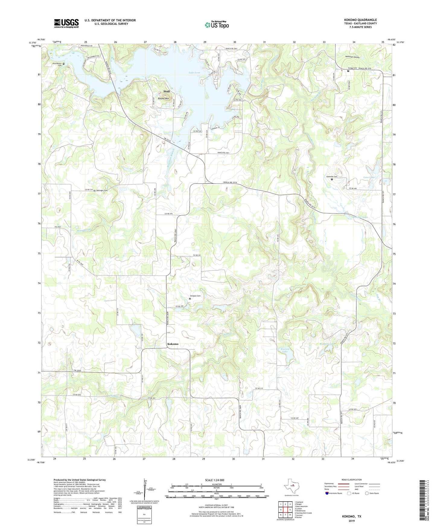
2022 topographic map quadrangle Kokomo in the state of Texas. Scale: 1:24000. Based on the newly updated USGS 7.5' US Topo map series, this map is in the following counties: Eastland. The map contains contour data, water features, and other items you are used to seeing on USGS maps, but also has updated roads and other features. This is the next generation of topographic maps. Printed on high-quality waterproof paper with UV fade-resistant inks.
Quads adjacent to this one:
West: Carbon
Northwest: Eastland
North: Ranger
Northeast: Bear Mountain
East: Desdemona
Southeast: Rucker
South: Gorman
Southwest: Hunting Shirt Creek
This map covers the same area as the classic USGS quad with code o32098c6.
Contains the following named places: Alameda Cemetery, Bollinger Cemetery, Colony Creek, Gorman Division, Gregg Cemetery, Hamilton Hollow, Jim Neal Branch, Kokomo, Lake Leon, Lake Leon Dam, Lick Branch, Lone Cedar Country Club, Love Dam, Love Lake, Mansker Lake, Mountain Branch, Nash Creek, Providence Cemetery, Rodgers Dam, Rodgers Lake, Rough Branch, Round Mountain, Salt Branch, Simpson Cemetery, Staff, Warren Dam, Warren Lake