MyTopo
Eastland Texas US Topo Map
Couldn't load pickup availability
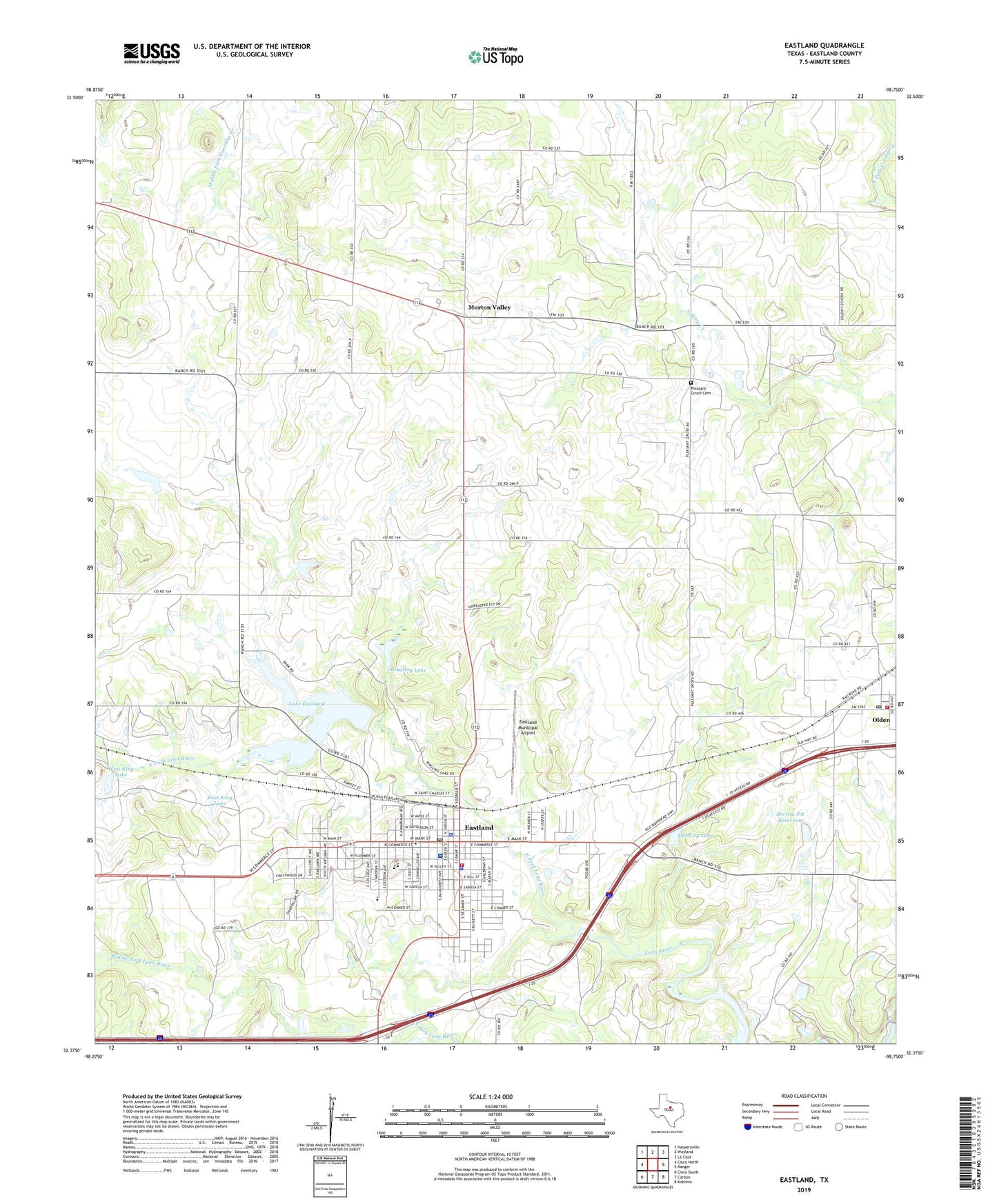
2022 topographic map quadrangle Eastland in the state of Texas. Scale: 1:24000. Based on the newly updated USGS 7.5' US Topo map series, this map is in the following counties: Eastland. The map contains contour data, water features, and other items you are used to seeing on USGS maps, but also has updated roads and other features. This is the next generation of topographic maps. Printed on high-quality waterproof paper with UV fade-resistant inks.
Quads adjacent to this one:
West: Cisco North
Northwest: Harpersville
North: Wayland
Northeast: La Casa
East: Ranger
Southeast: Kokomo
South: Carbon
Southwest: Cisco South
This map covers the same area as the classic USGS quad with code o32098d7.
Contains the following named places: Alhambra Theater, Bethel Baptist Church, Borrow Pit Reservoir, Borrow Pit Reservoir Dam, Church of Christ, City of Eastland, East King Dam, East King Lake, Eastland, Eastland City Hall, Eastland County Jail, Eastland County Sheriff's Office, Eastland Division, Eastland Fire Department, Eastland High School, Eastland Memorial Hospital, Eastland Middle School, Eastland Municipal Airport, Eastland Police Department, Eastland Post Office, Eastland Quarry, First Baptist Church, First United Methodist Church of Eastland, Holy Trinity Episcopal Church, KATX-FM (Eastland), KEAS-AM (Eastland), KEAS-FM (Eastland), KVMX-FM (Eastland), Lake Brelsford, Lake Eastland, Lake Eastland Dam, Liberty Baptist Church, Lone Star Pumping Station, Lyric Theater, Majestic Theatre, Middle Fork Leon River, Morton Valley, North Fork Leon River, Old City Lake, Old City Lake Dam, Olden, Olden Post Office, Olden Volunteer Fire Department, Pleasant Grove Cemetery, Princess Theater, Ringling Lake, Ringling Lake Dam, Siebert Elementary School, South Fork Leon River, Texas Department of Public Safety - Eastland Office, United Pentecostal Church, West King Dam, West King Lake, ZIP Code: 76448