MyTopo
Cisco North Texas US Topo Map
Couldn't load pickup availability
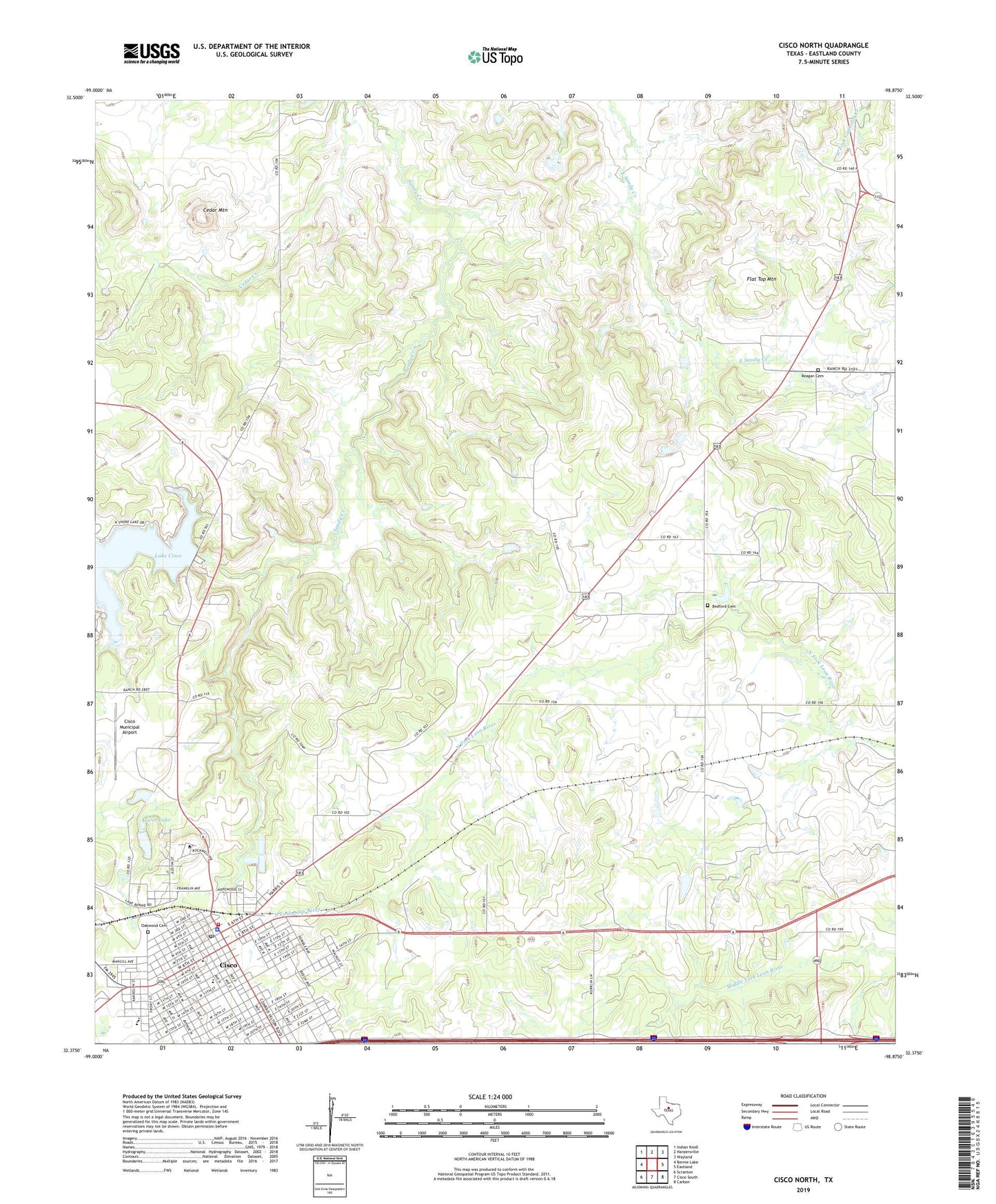
2022 topographic map quadrangle Cisco North in the state of Texas. Scale: 1:24000. Based on the newly updated USGS 7.5' US Topo map series, this map is in the following counties: Eastland. The map contains contour data, water features, and other items you are used to seeing on USGS maps, but also has updated roads and other features. This is the next generation of topographic maps. Printed on high-quality waterproof paper with UV fade-resistant inks.
Quads adjacent to this one:
West: Bernie Lake
Northwest: Indian Knoll
North: Harpersville
Northeast: Wayland
East: Eastland
Southeast: Carbon
South: Cisco South
Southwest: Scranton
This map covers the same area as the classic USGS quad with code o32098d8.
Contains the following named places: Bankline Owens Oil Field, Bedford Cemetery, Bible Baptist Church, Cedar Mountain, Chesley Stadium, Cisco, Cisco City Hall, Cisco Elementary School, Cisco Emergency Medical Service, Cisco Fire Department, Cisco High School, Cisco Historic District, Cisco Junior College, Cisco Junior High School, Cisco Learning Center, Cisco Municipal Airport, Cisco Police Department, Cisco Post Office, City of Cisco, East Cisco Baptist Church, Eastland County Constable's Office Precinct 1, First Presbyterian Church, Flat Top Mountain, Grace Fellowship Church, Klelner Oil Field, Mobley Hotel, Oakwood Cemetery, Reagan Cemetery, Twin Lake, Twin Lake Dam, Williamson Dam