MyTopo
Carrizo Springs NW Texas US Topo Map
Couldn't load pickup availability
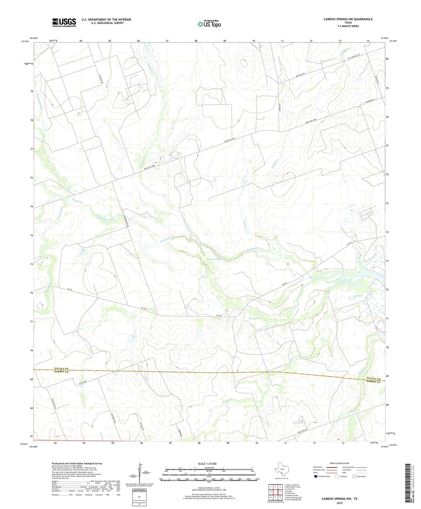
2022 topographic map quadrangle Carrizo Springs NW in the state of Texas. Scale: 1:24000. Based on the newly updated USGS 7.5' US Topo map series, this map is in the following counties: Zavala, Dimmit. The map contains contour data, water features, and other items you are used to seeing on USGS maps, but also has updated roads and other features. This is the next generation of topographic maps. Printed on high-quality waterproof paper with UV fade-resistant inks.
Quads adjacent to this one:
West: Cometa
Northwest: Chacon Creek SE
North: Beef Hollow Creek
Northeast: La Pryor SE
East: Crystal City
Southeast: Carrizo Springs East
South: Carrizo Springs West
Southwest: Cayetano Creek
This map covers the same area as the classic USGS quad with code o28099f8.
Contains the following named places: Capota Creek, Comanche Creek, Crooked Lake, Fishhook Lake, Palo Blanco Creek, Pendencia Creek, Picosa Creek, Rocky Lake