MyTopo
Cerro Castellan Texas US Topo Map
Couldn't load pickup availability
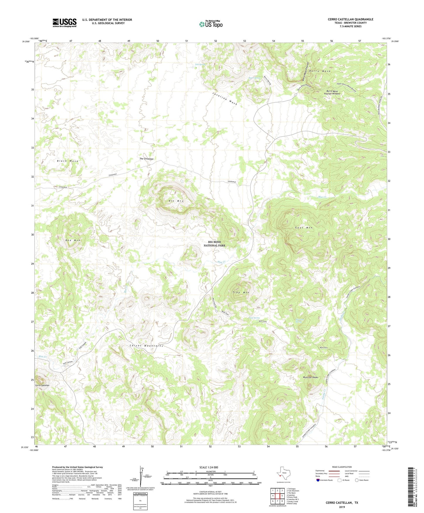
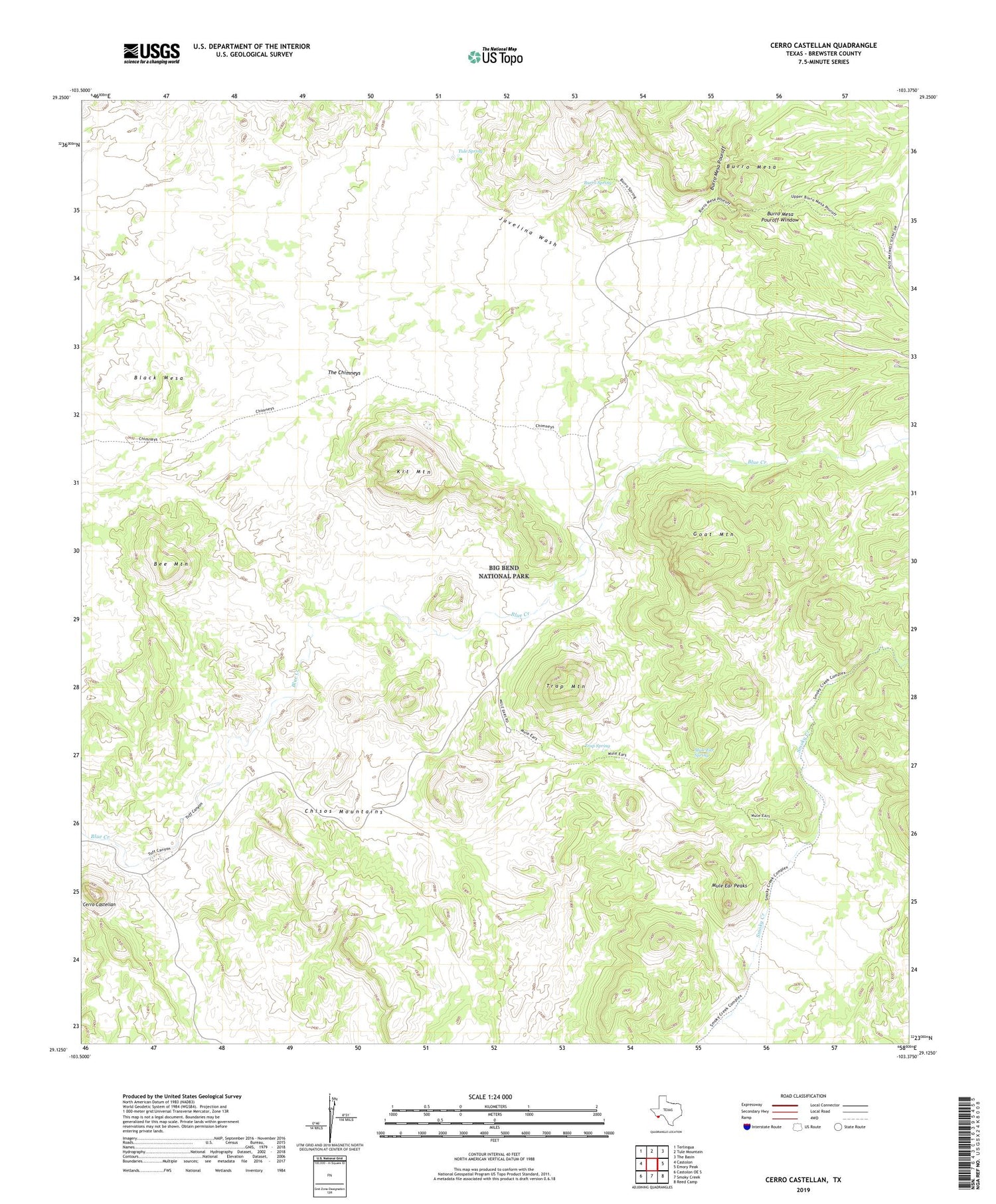
2019 topographic map quadrangle Cerro Castellan in the state of Texas. Scale: 1:24000. Based on the newly updated USGS 7.5' US Topo map series, this map is in the following counties: Brewster. The map contains contour data, water features, and other items you are used to seeing on USGS maps, but also has updated roads and other features. This is the next generation of topographic maps. Printed on high-quality waterproof paper with UV fade-resistant inks.
Quads adjacent to this one:
West: Castolon
Northwest: Terlingua
North: Tule Mountain
Northeast: The Basin
East: Emory Peak
Southeast: Reed Camp
South: Smoky Creek
Southwest: Castolon OE S
Contains the following named places: Bee Mountain, Black Mesa, Burro Mesa, Burro Mesa Pouroff, Burro Mesa Pouroff Trail, Burro Mesa Pouroff Window, Burro Mesa Spring Trail, Burro Spring, Cerro Castellan, Chimneys Trail, Goat Mountain, Kit Mountain, Mule Ear Overlook, Mule Ear Peaks, Mule Ear Spring, Mule Ears - Smoky Creek Trail, Sotol Vista Overlook, The Chimneys, Trap Mountain, Trap Spring, Tuff Canyon, Tuff Canyon Trail, Tule Spring