MyTopo
Terlingua Texas US Topo Map
Couldn't load pickup availability
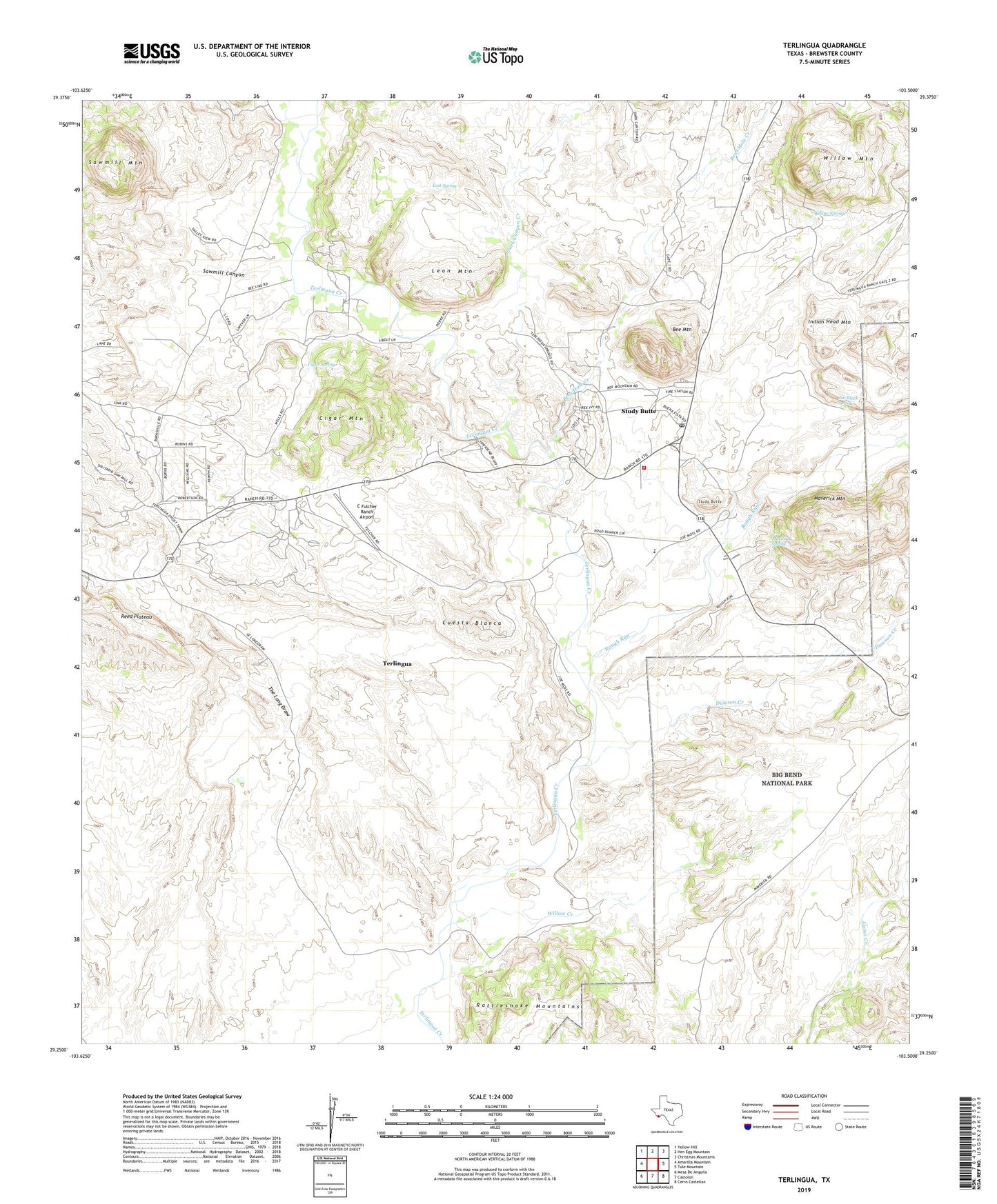
2022 topographic map quadrangle Terlingua in the state of Texas. Scale: 1:24000. Based on the newly updated USGS 7.5' US Topo map series, this map is in the following counties: Brewster. The map contains contour data, water features, and other items you are used to seeing on USGS maps, but also has updated roads and other features. This is the next generation of topographic maps. Printed on high-quality waterproof paper with UV fade-resistant inks.
Quads adjacent to this one:
West: Amarilla Mountain
Northwest: Yellow Hill
North: Hen Egg Mountain
Northeast: Christmas Mountains
East: Tule Mountain
Southeast: Cerro Castellan
South: Castolon
Southwest: Mesa De Anguila
This map covers the same area as the classic USGS quad with code o29103c5.
Contains the following named places: Bee Mountain, Bens Hole Creek, Big Bend High School, C Fulcher Ranch Airport, Cigar Mountain, Cigar Spring, Cuesta Blanca, Dark Canyon Creek, Dawson Creek, Indian Head Mountain, Joe Black Spring, La Leona Airport, Leon Mountain, Lost Spring, Maverick Mountain, Maverick Spring, Rough Run, Sawmill Canyon, Sawmill Mountain, Study Butte, Study Butte Cemetery, Study Butte Census Designated Place, Study Butte-Terlingua Census Designated Place, Terlingua, Terlingua Cemetery, Terlingua Census Designated Place, Terlingua Elementary School, Terlingua Fire / EMS Department, Terlingua Historic District, Terlingua Post Office, The Long Draw, Willow Creek, Willow Mountain, Willow Spring