MyTopo
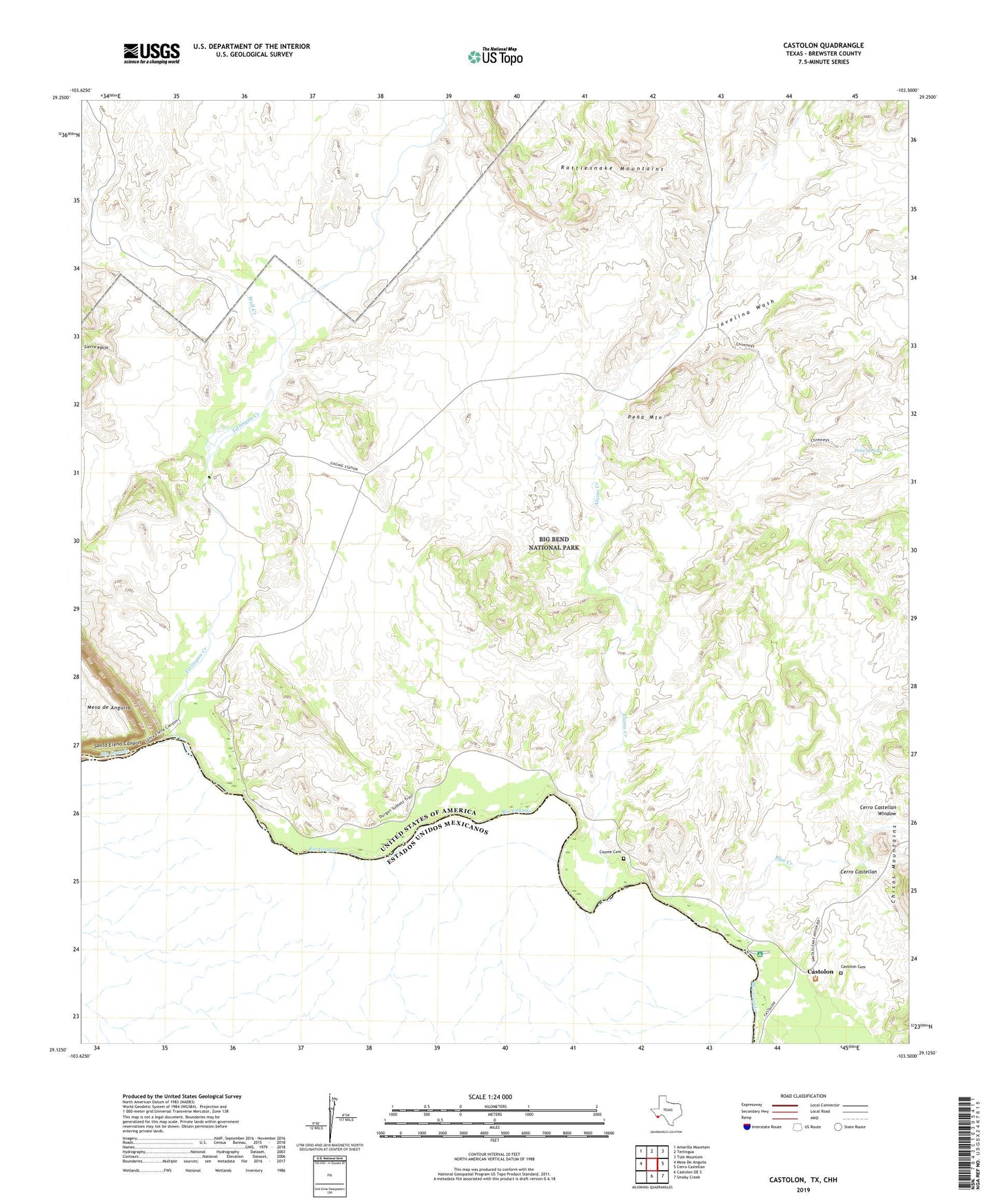
Castolon Texas US Topo Map
Couldn't load pickup availability
2022 topographic map quadrangle Castolon in the state of Texas. Scale: 1:24000. Based on the newly updated USGS 7.5' US Topo map series, this map is in the following counties: Brewster. The map contains contour data, water features, and other items you are used to seeing on USGS maps, but also has updated roads and other features. This is the next generation of topographic maps. Printed on high-quality waterproof paper with UV fade-resistant inks.
Quads adjacent to this one:
West: Mesa De Anguila
Northwest: Amarilla Mountain
North: Terlingua
Northeast: Tule Mountain
East: Cerro Castellan
Southeast: Smoky Creek
South: Castolon OE S
This map covers the same area as the classic USGS quad with code o29103b5.
Contains the following named places: Alamo Creek, Blue Creek, Castolon, Castolon Cemetery, Castolon Historic District, Cerro Castellan Window, Cottonwood Campground, Coyote Cemetery, Drydens Ranch, Javelina Wash, La Coyota, Luna Jacal Building, Lunas, Pena Mountain, Pena Spring, Rancho Estelle, Rattlesnake Mountains, Santa Elena Canyon, Santa Elena Canyon Lookout, Santa Elena Canyon Trail, Terlingua Abaja, Terlingua Creek, Terlingua de Abajo Cemetery, Well Creek