MyTopo
Smoky Creek Texas US Topo Map
Couldn't load pickup availability
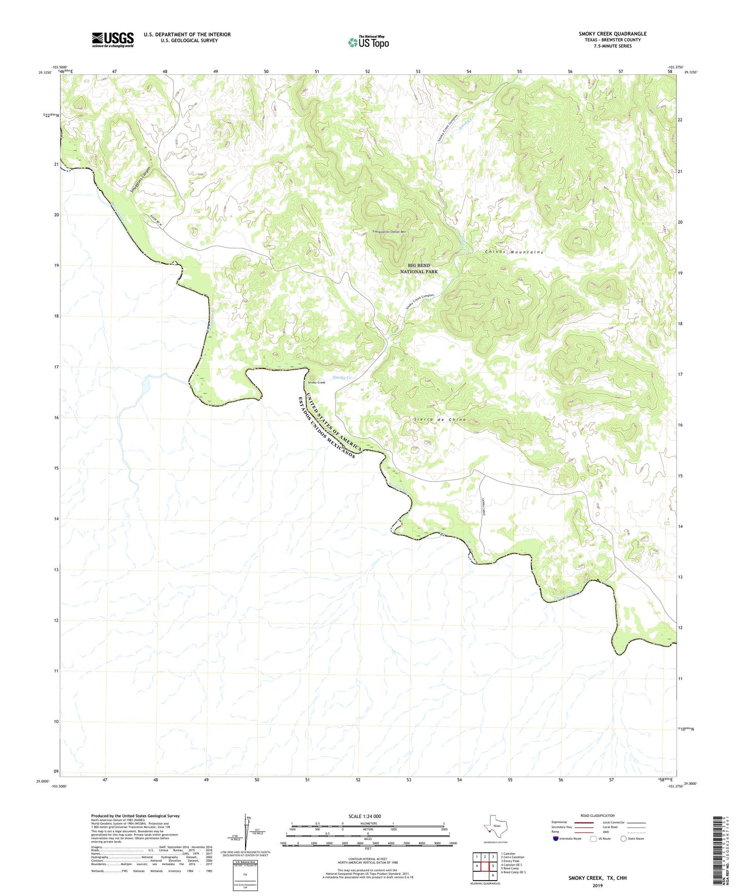
2022 topographic map quadrangle Smoky Creek in the state of Texas. Scale: 1:24000. Based on the newly updated USGS 7.5' US Topo map series, this map is in the following counties: Brewster. The map contains contour data, water features, and other items you are used to seeing on USGS maps, but also has updated roads and other features. This is the next generation of topographic maps. Printed on high-quality waterproof paper with UV fade-resistant inks.
Quads adjacent to this one:
West: Castolon OE S
Northwest: Castolon
North: Cerro Castellan
Northeast: Emory Peak
East: Reed Camp
Southeast: Reed Camp OE S
This map covers the same area as the classic USGS quad with code o29103a4.
Contains the following named places: Black Dike, Buenos Aires, Sierra Chino, Sierra de Chino, Smoky Creek, Smugglers Canyon, Triangulation Station Mountain