MyTopo
Charco Texas US Topo Map
Couldn't load pickup availability
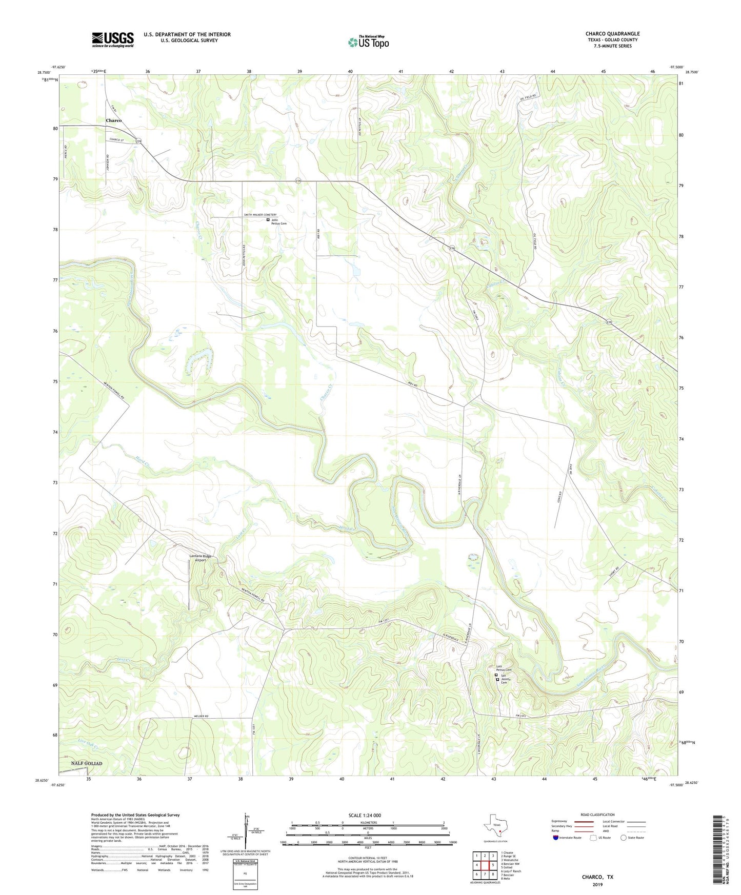
2022 topographic map quadrangle Charco in the state of Texas. Scale: 1:24000. Based on the newly updated USGS 7.5' US Topo map series, this map is in the following counties: Goliad. The map contains contour data, water features, and other items you are used to seeing on USGS maps, but also has updated roads and other features. This is the next generation of topographic maps. Printed on high-quality waterproof paper with UV fade-resistant inks.
Quads adjacent to this one:
West: Berclair NW
Northwest: Choate
North: Runge SE
Northeast: Weesatche
East: Goliad
Southeast: Melo
South: Berclair
Southwest: Lazy F Ranch
This map covers the same area as the classic USGS quad with code o28097f5.
Contains the following named places: Albrecht Gas Field, Angel City, Charco, Charco Creek, Charco Southeast Gas Field, Dial Ranch, Hord Creek, Irby Ranch, John Pettus Cemetery, Lantana Ridge Airport, Lost Creek, Lott Pettus Cemetery, Riverdale, San Jasinto Cemetery