MyTopo
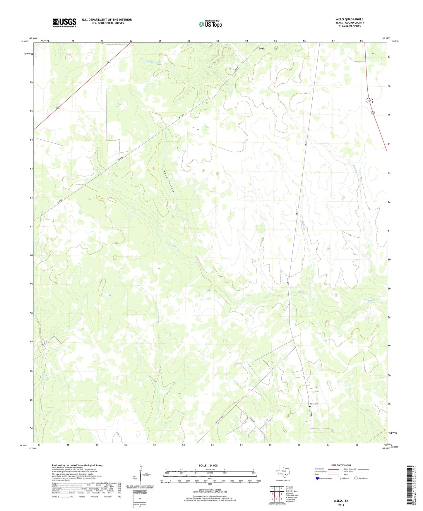
Melo Texas US Topo Map
Couldn't load pickup availability
2022 topographic map quadrangle Melo in the state of Texas. Scale: 1:24000. Based on the newly updated USGS 7.5' US Topo map series, this map is in the following counties: Goliad. The map contains contour data, water features, and other items you are used to seeing on USGS maps, but also has updated roads and other features. This is the next generation of topographic maps. Printed on high-quality waterproof paper with UV fade-resistant inks.
Quads adjacent to this one:
West: Berclair
Northwest: Charco
North: Goliad
Northeast: Hensley Lake
East: Live Oak Lake
Southeast: Ryanville
South: Blanconia
Southwest: Skidmore NE
This map covers the same area as the classic USGS quad with code o28097e4.
Contains the following named places: Airfield Windmill, Bissitt Ranch, Bissitt Windmill, Brahman Windmill, Byrnes Windmill, Clip Ranch, Coyote Windmill, Elkins Branch, Elkins Windmill, Gin Windmill, Goliad South Division, Henke Windmill, Keys Hollow, Lake Windmill, Lott Windmill, Lower Buzzard Windmill, Melo, Melo Ranch, Number Four Windmill, Number One Windmill, Number Three Windmill, Number Two Windmill, Ramirez Windmill, Red Windmill, Samson Windmill, Sarco, Sarco Cemetery, Spangle Windmill, Upper Buzzard Windmill, Winter Windmill