
MyTopo
Cherry Spring Texas US Topo Map
Couldn't load pickup availability
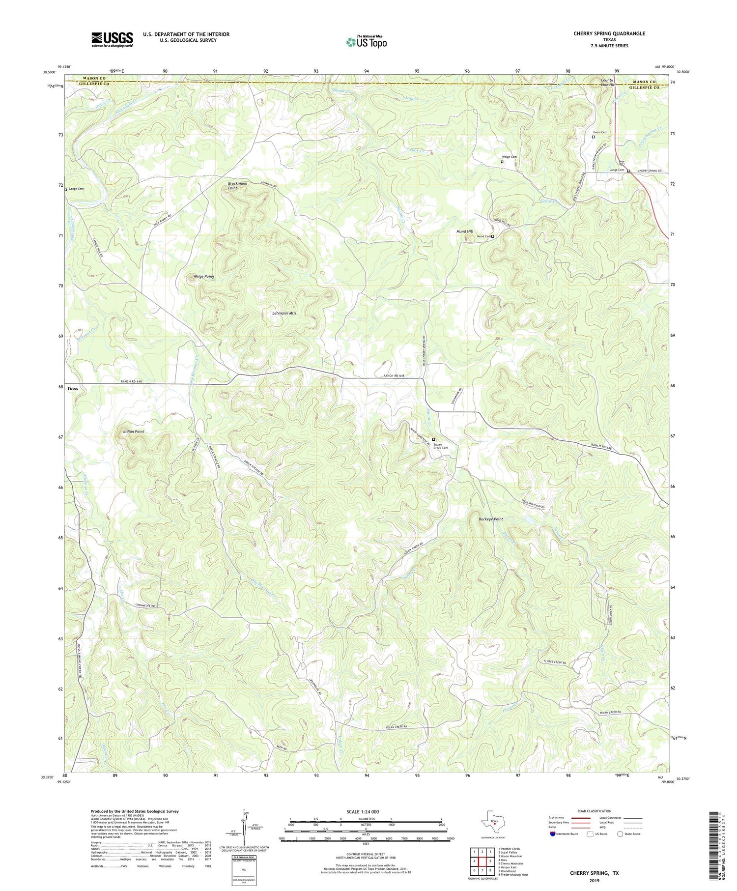
2019 topographic map quadrangle Cherry Spring in the state of Texas. Scale: 1:24000. Based on the newly updated USGS 7.5' US Topo map series, this map is in the following counties: Gillespie, Mason. The map contains contour data, water features, and other items you are used to seeing on USGS maps, but also has updated roads and other features. This is the next generation of topographic maps. Printed on high-quality waterproof paper with UV fade-resistant inks.
Quads adjacent to this one:
West: Doss
Northwest: Panther Creek
North: Loyal Valley
Northeast: House Mountain
East: Cherry Mountain
Southeast: Fredericksburg West
South: Roundhead
Southwest: Harper East
Contains the following named places: Brockmann Point, Buckeye Point, Cedar Creek, Cherry Spring, County Line Hill, Dry Mormon Creek, Elm Creek, Evers Cemetery, Flores Creek, Hog Creek, Indian Creek, Indian Point, Lange Cemetery, Lehmann Mountain, Mund Cemetery, Mund Hill, Neyland Mine, Nixon Creek, Onion Creek, Squaw Creek Cemetery, Squaw Creek Church, Welge Cemetery, Welge Poing


