MyTopo
Fredericksburg West Texas US Topo Map
Couldn't load pickup availability
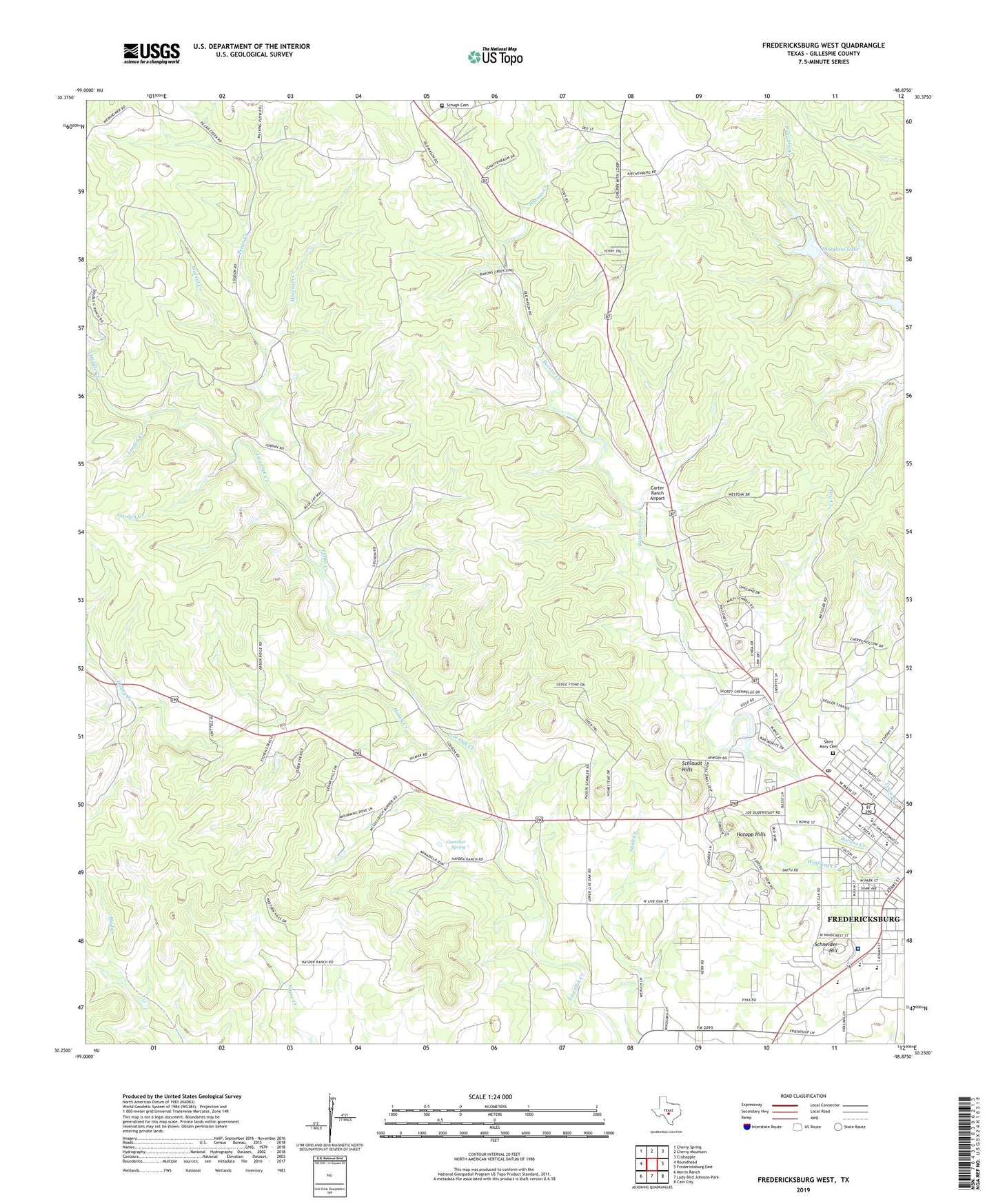
2022 topographic map quadrangle Fredericksburg West in the state of Texas. Scale: 1:24000. Based on the newly updated USGS 7.5' US Topo map series, this map is in the following counties: Gillespie. The map contains contour data, water features, and other items you are used to seeing on USGS maps, but also has updated roads and other features. This is the next generation of topographic maps. Printed on high-quality waterproof paper with UV fade-resistant inks.
Quads adjacent to this one:
West: Roundhead
Northwest: Cherry Spring
North: Cherry Mountain
Northeast: Crabapple
East: Fredericksburg East
Southeast: Cain City
South: Lady Bird Johnson Park
Southwest: Morris Ranch
This map covers the same area as the classic USGS quad with code o30098c8.
Contains the following named places: Carter Ranch Airport, Cisco Public Library, City of Fredericksburg, Douglass Lake, Douglass Lake Dam, Dry Creek, Fredericksburg Alternative School, Fredericksburg Division, Fredericksburg High School, Fredericksburg Historic District, Fredericksburg Learning Center, Fredericksburg Post Office, Garden Creek, Gillespie County, Gillespie County Historical Society, Guenther Spring, Hill Country Memorial Hospital, Honey Creek, Hotopp Hills, KNAF-AM (Fredericksburg), Linden Creek, Middle Creek, Moccasin Creek, Pecan Creek, Saint Barnabas Episcopal Church, Saint Mary Cemetery, Saint Mary School, Saint Marys Catholic Church, Saint Marys Catholic Church Youth Ministry, Schlaudt Hills, Schneider Hill, Schugh Cemetery, Seventh Day Adventist Church, Town Creek, Walnut Creek, Winfried Creek, Zion Lutheran Church, ZIP Code: 78624