MyTopo
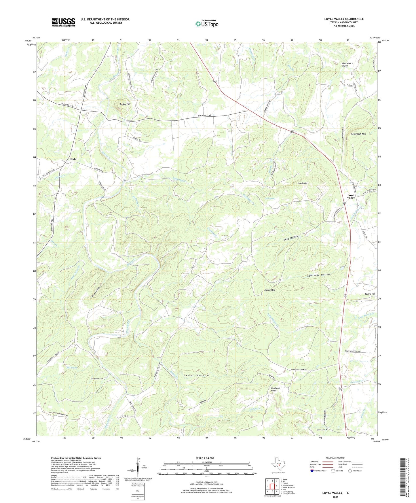
Loyal Valley Texas US Topo Map
Couldn't load pickup availability
2023 topographic map quadrangle Loyal Valley in the state of Texas. Scale: 1:24000. Based on the newly updated USGS 7.5' US Topo map series, this map is in the following counties: Mason. The map contains contour data, water features, and other items you are used to seeing on USGS maps, but also has updated roads and other features. This is the next generation of topographic maps. Printed on high-quality waterproof paper with UV fade-resistant inks.
Quads adjacent to this one:
West: Panther Creek
Northwest: Mason
North: Art
Northeast: Castell
East: House Mountain
Southeast: Cherry Mountain
South: Cherry Spring
Southwest: Doss
This map covers the same area as the classic USGS quad with code o30099e1.
Contains the following named places: Birdsong Creek, Blue Canyon, Brockman Creek, Cedar Hollow, Church Creek, Cold Spring, Cow Valley Creek, Deep Hollow, Deer Creek, Ellerbracht Cemetery, Flathead Point, Hilda, House Creek, Kothe Cemetery, Lawrence Hollow, Loyal Mountain, Loyal Valley, Mason Mountain, Meusebach Mountain, Spring Branch, Spring Hill, Squaw Creek, Threadgill Creek, Turkey Hill, Weideman Creek, Willow Creek