MyTopo
Cherry Mountain Texas US Topo Map
Couldn't load pickup availability
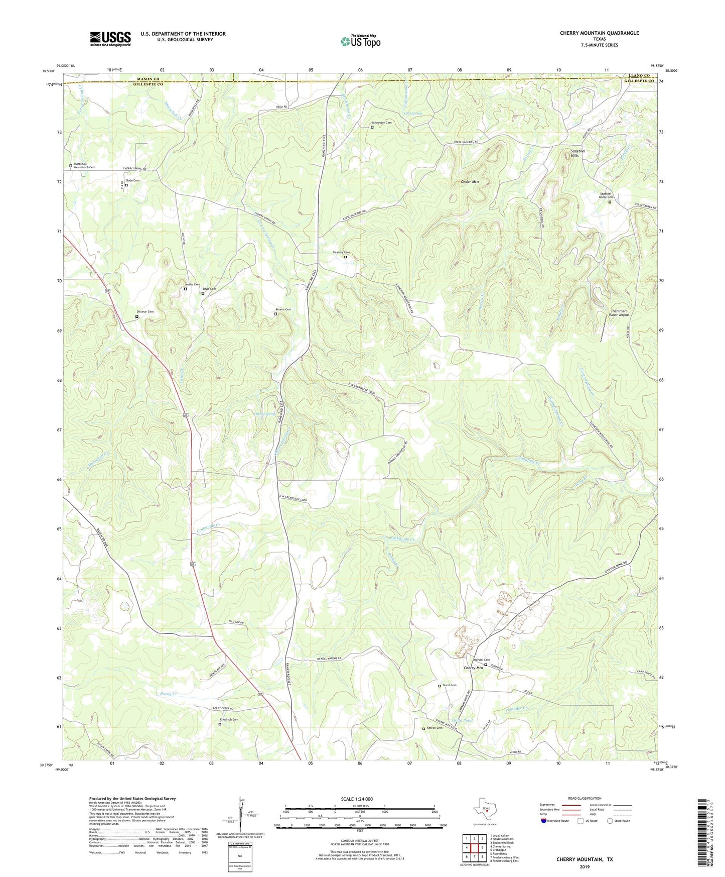
2022 topographic map quadrangle Cherry Mountain in the state of Texas. Scale: 1:24000. Based on the newly updated USGS 7.5' US Topo map series, this map is in the following counties: Gillespie, Llano, Mason. The map contains contour data, water features, and other items you are used to seeing on USGS maps, but also has updated roads and other features. This is the next generation of topographic maps. Printed on high-quality waterproof paper with UV fade-resistant inks.
Quads adjacent to this one:
West: Cherry Spring
Northwest: Loyal Valley
North: House Mountain
Northeast: Enchanted Rock
East: Crabapple
Southeast: Fredericksburg East
South: Fredericksburg West
Southwest: Roundhead
This map covers the same area as the classic USGS quad with code o30098d8.
Contains the following named places: Ahrens Cemetery Number 1, Cedar Mountain, Cherry Mountain, Cherry Mountain Mine, Cherry Spring, Cherry Spring Community Centery, Cold Spring, Dearing Cemetery, Diedrich - Rode Cemetery, Dittmar Cemetery, Durst Cemetery, Friedrich Cemetery, Hilltop, Holly Pond, Ketron Cemetery, Kothe Cemetery, Little Creek, Long Branch, Marschall Meusebach Cemetery, Pecan Spring Creek, Rocky Creek, Rode Cemetery, Sagebiel Hills, Sagebiel-Keese Cemetery, Schneider Cemetery, Tschirhart Ranch Airport, Walnut Spring Creek, Wendel Cemetery