MyTopo
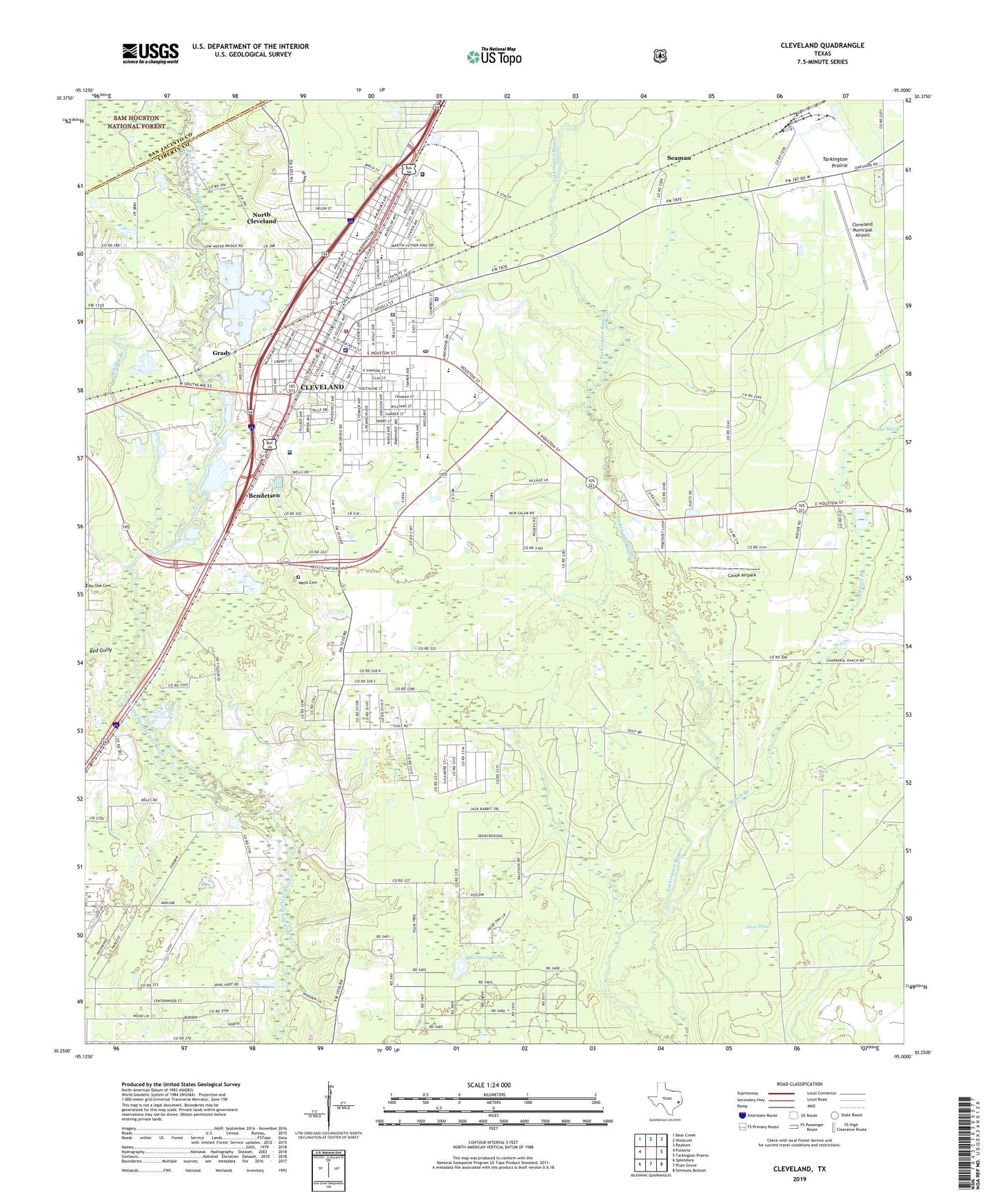
Cleveland Texas US Topo Map
Couldn't load pickup availability
2019 topographic map quadrangle Cleveland in the state of Texas. Scale: 1:24000. Based on the newly updated USGS 7.5' US Topo map series, this map is in the following counties: Liberty, San Jacinto. The map contains contour data, water features, and other items you are used to seeing on USGS maps, but also has updated roads and other features. This is the next generation of topographic maps. Printed on high-quality waterproof paper with UV fade-resistant inks.
Quads adjacent to this one:
West: Fostoria
Northwest: Bear Creek
North: Westcott
Northeast: Rayburn
East: Tarkington Prairie
Southeast: Simmons Bottom
South: Plum Grove
Southwest: Splendora
Contains the following named places: Ainsworth, Allan Pond, Bendetsen, Bethel Assembly of God Church, Calvary Baptist Church, Casa de Dios Assembly of God Church, Cavok Airpark, Central Baptist Church, City of Cleveland, City of Cleveland Fire Department, City of North Cleveland, Cleveland, Cleveland City Hall, Cleveland Emergency Medical Services, Cleveland High School, Cleveland Junior High School, Cleveland Missionary Baptist Church, Cleveland Municipal Airport, Cleveland Police Department, Cleveland Post Office, Cleveland Volunteer Fire Department Station 1, Cleveland Volunteer Fire Department Station 2, Doctors Diagnostic Hospital, Douglass School, First United Methodist Church of Cleveland, Galilee Missionary Baptist Church, Gladstell, Good Shepherd Lutheran Church, Grace, Grace Church, Grady, Greater Pilgrim Rest Baptist Church, KLEV-AM (Cleveland), KVLB Radio Station, KVLS, Leggett Memorial Hospital, Liberty County Constable's Office Precinct 6, Liberty County Sheriff's Office, Marsh Branch, McCoy Gas and Oil Field, Moccasin Pond, New Bethel African Methodist Episcopal Church, New Bethel Baptist Church, New Salem Church, Nimrod, North Cleveland Baptist Church, North Cleveland City Hall, North Side School, Northside Elementary School, Pelican, Pelican Oil Field, Pin Oak Church, Red Gully, Saint Marks Episcopal Church, Seaman, Snuff Ridge, South Cleveland Oil Field, South Side School, Southside Primary School, Stancil Park, Tabernacle Baptist Church, Temple Greater McGowan Church of God and Christ, Texas Department of Criminal Justice Cleveland Correctional Center, Texas Rural Hospital, The Marsh, Wells Cemetery, Whisky Branch, Williams