MyTopo
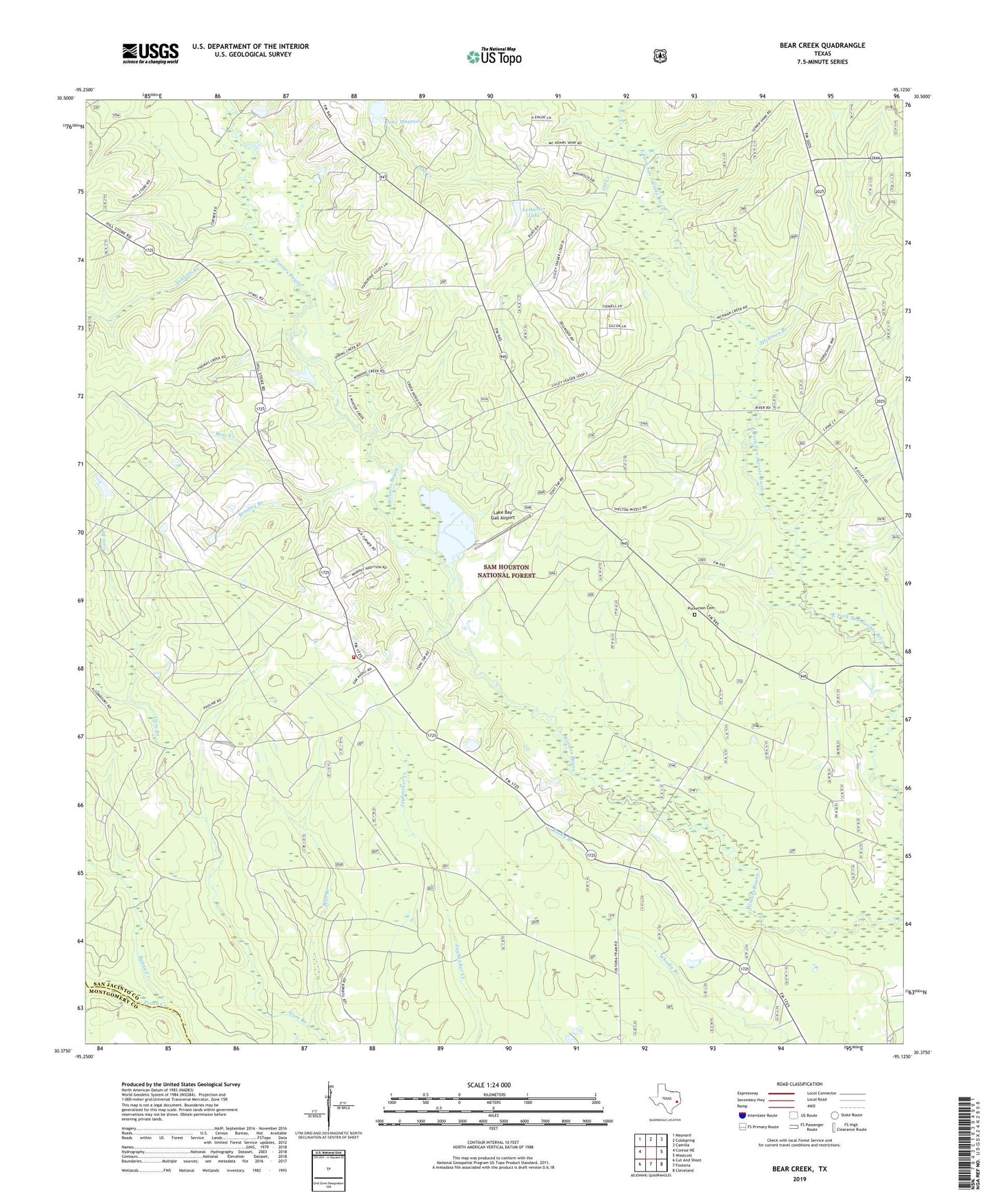
Bear Creek Texas US Topo Map
Couldn't load pickup availability
Also explore the Bear Creek Forest Service Topo of this same quad for updated USFS data
2022 topographic map quadrangle Bear Creek in the state of Texas. Scale: 1:24000. Based on the newly updated USGS 7.5' US Topo map series, this map is in the following counties: San Jacinto, Montgomery. The map contains contour data, water features, and other items you are used to seeing on USGS maps, but also has updated roads and other features. This is the next generation of topographic maps. Printed on high-quality waterproof paper with UV fade-resistant inks.
Quads adjacent to this one:
West: Conroe NE
Northwest: Maynard
North: Coldspring
Northeast: Camilla
East: Westcott
Southeast: Cleveland
South: Fostoria
Southwest: Cut And Shoot
This map covers the same area as the classic USGS quad with code o30095d2.
Contains the following named places: Bass Breeze Ranch Airport, Bear Creek, Bear Creek Volunteer Fire Department, Blue Branch, Boggy Creek, Bradley Branch, Hickman Branch, Howard Lake, Howard Lake Dam, Lake Baygall, Lake Magnolia, Letbetter Lake, Magnolia, Magnolia Church, Mercy Oil Field, Montague Church, Nebletts Creek, Oak Grove, Oil Creek, Pleasant Grove Church, Purkerson Cemetery, Rocky Branch, San Jacinto County Constable's Office Precinct 3, San Jacipto Work Center, Shell Hunter Camp, Shepherd-Evergreen Division, Williams Lake, Williams Lake Dam, ZIP Code: 77328