MyTopo
Clifton Texas US Topo Map
Couldn't load pickup availability
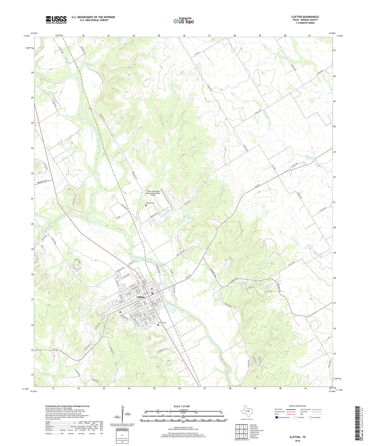
2019 topographic map quadrangle Clifton in the state of Texas. Scale: 1:24000. Based on the newly updated USGS 7.5' US Topo map series, this map is in the following counties: Bosque. The map contains contour data, water features, and other items you are used to seeing on USGS maps, but also has updated roads and other features. This is the next generation of topographic maps. Printed on high-quality waterproof paper with UV fade-resistant inks.
Quads adjacent to this one:
West: Sugarloaf Mountain
Northwest: Meridian
North: Pilot Knob
Northeast: Allen Bend
East: Laguna Park
Southeast: Valley Mills
South: Mosheim
Southwest: Hurst Spring
Contains the following named places: Bosque, Bosque Memorial Museum, City of Clifton, Clifton, Clifton Cemetery, Clifton City Hall, Clifton Elementary School, Clifton Memorial Park, Clifton Middle School, Clifton Municipal Airport/Isenhower Field, Clifton Police Department, Clifton Post Office, Clifton Volunteer Fire Department, Cub Stadium, First Baptist Church, First Presbyterian Church, Fundamental Baptist Church, Goodall - Witcher Healthcare Foundation Hospital, Grace Memorial Baptist Church, Gunarus and Ingerborg Shefstad House, Holy Angels Catholic Church, J H Bekken House, KWOW-FM (Clifton), Meridian Creek, Mermaid Swimming Pool, North Bosque Emergency Medical Services, Old Mill Dam, Old Mill Lake, Olsen Lake, Olsen Lake Dam, Oswald Cemetery, Peder Dahl Farm, Pentecostal Church of God, Saint Pauls Church, Schumacher Creek, Shiloh Baptist Church, Sunset Home, Trinity Lutheran Church, Womack Hall, ZIP Code: 76634