MyTopo
Allen Bend Texas US Topo Map
Couldn't load pickup availability
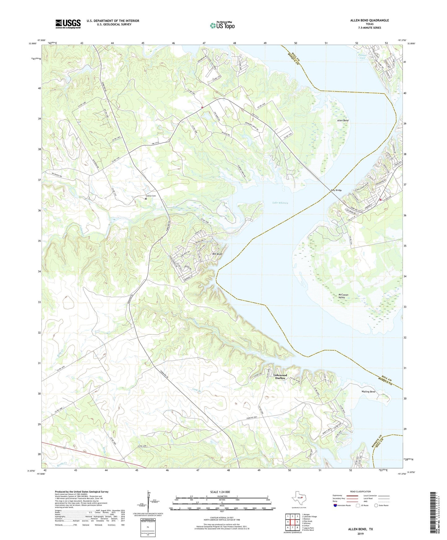
2022 topographic map quadrangle Allen Bend in the state of Texas. Scale: 1:24000. Based on the newly updated USGS 7.5' US Topo map series, this map is in the following counties: Bosque, Hill. The map contains contour data, water features, and other items you are used to seeing on USGS maps, but also has updated roads and other features. This is the next generation of topographic maps. Printed on high-quality waterproof paper with UV fade-resistant inks.
Quads adjacent to this one:
West: Pilot Knob
Northwest: Morgan
North: Lakeside Village
Northeast: Blanton
East: Whitney
Southeast: Smiths Bend
South: Laguna Park
Southwest: Clifton
This map covers the same area as the classic USGS quad with code o31097h4.
Contains the following named places: Allen Bend, Bee Bluff, Cedar Creek, Cedar Shores, Cedron Cemetery, Cedron Creek, Cedron Creek Park, Falls Branch, Frazier Creek, Katy Bridge, King Creek, Lakeview Volunteer Fire Department, Lakewood Harbor, Long Branch, McCowan Valley, McCowan Valley Park, McCown Valley Park, Pioneer Cove, Rocky Creek, Steele Creek Acres Volunteer Fire Department, Steiner Church, Walling Bend, Walling Bend Park