MyTopo
Sugarloaf Mountain Texas US Topo Map
Couldn't load pickup availability
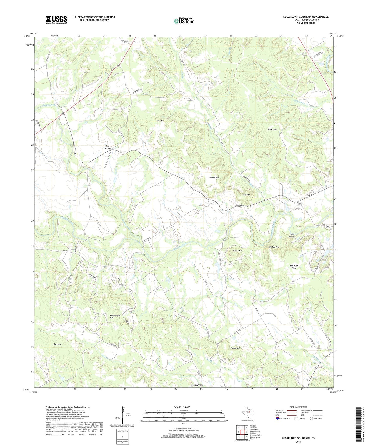
2022 topographic map quadrangle Sugarloaf Mountain in the state of Texas. Scale: 1:24000. Based on the newly updated USGS 7.5' US Topo map series, this map is in the following counties: Bosque. The map contains contour data, water features, and other items you are used to seeing on USGS maps, but also has updated roads and other features. This is the next generation of topographic maps. Printed on high-quality waterproof paper with UV fade-resistant inks.
Quads adjacent to this one:
West: Cranfills Gap
Northwest: Iredell
North: Meridian
Northeast: Pilot Knob
East: Clifton
Southeast: Mosheim
South: Hurst Spring
Southwest: German Valley
This map covers the same area as the classic USGS quad with code o31097g6.
Contains the following named places: Arrs Mountain, Bee Creek, Bee Rock Flats, Big Bee Mountain, Brandhagen Houses, Brogdon Farm, Bronstad House, Brown Mountain, Carl and Sedsel Questad Farm, Christen and Johanne Knudson Farm, Ellingson Farm, Eric and Martha Linberg Farm, Even and Petrine Erickson Farm, Gary Mountain, Golden Mountain, Hans and Berthe Reierson House, James Jens and Martha Jenson House, Joseph and Anna Olson Farm, Kay Mountain, Little Bee Mountain, Midway Store, Norse, Norse Gold Mine, Norse Hill, Ole and Ann Pierson Farm, Olson-Nelson Farm, Our Saviors Church, Rattlesnake Mountain, Round Mountain, Spring Creek, Sugarloaf Mountain, Talley Airport, Wilson Homesite