MyTopo
Hurst Spring Texas US Topo Map
Couldn't load pickup availability
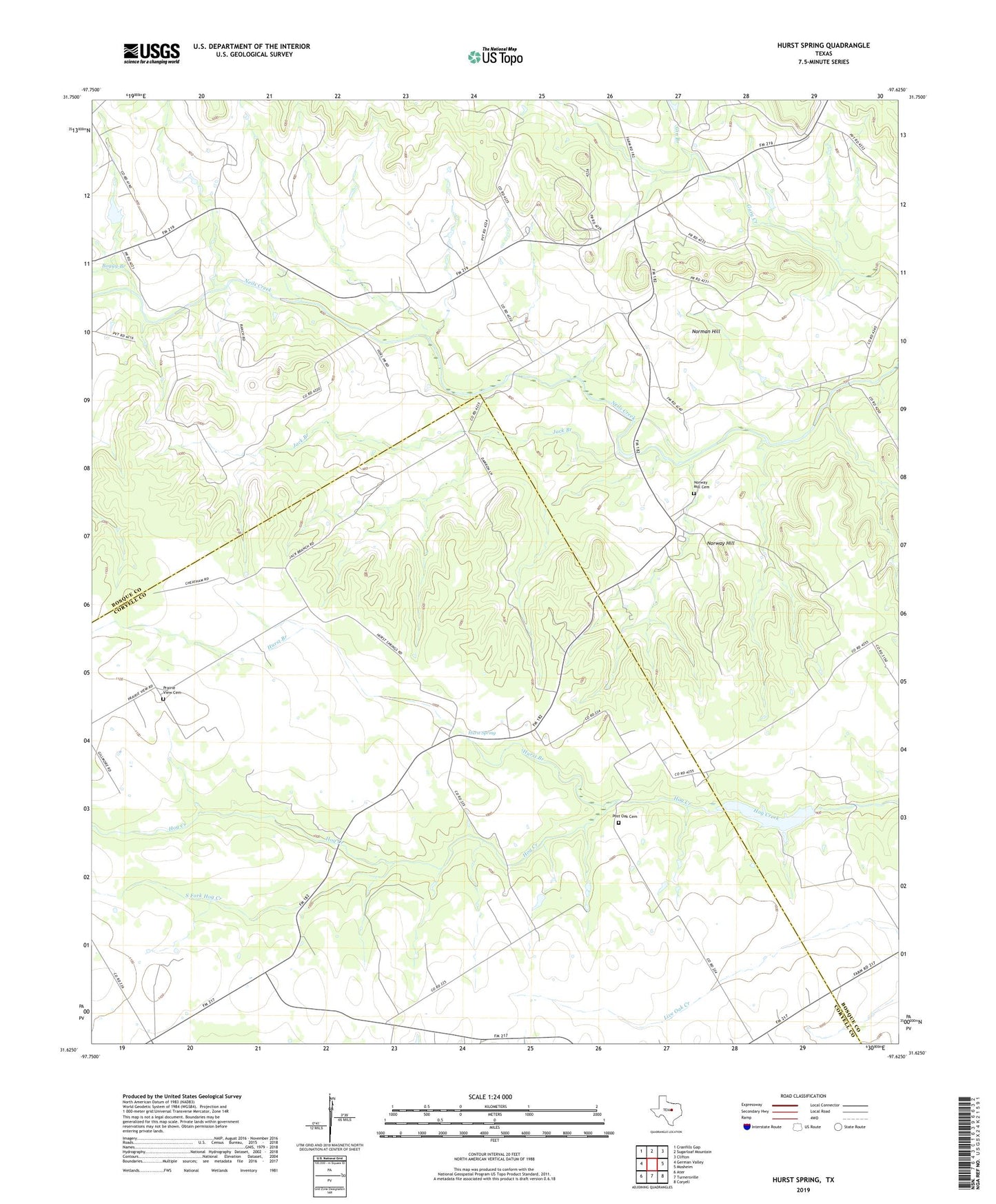
2022 topographic map quadrangle Hurst Spring in the state of Texas. Scale: 1:24000. Based on the newly updated USGS 7.5' US Topo map series, this map is in the following counties: Bosque, Coryell. The map contains contour data, water features, and other items you are used to seeing on USGS maps, but also has updated roads and other features. This is the next generation of topographic maps. Printed on high-quality waterproof paper with UV fade-resistant inks.
Quads adjacent to this one:
West: German Valley
Northwest: Cranfills Gap
North: Sugarloaf Mountain
Northeast: Clifton
East: Mosheim
Southeast: Coryell
South: Turnersville
Southwest: Ater
This map covers the same area as the classic USGS quad with code o31097f6.
Contains the following named places: A H Lahlum House, Boggy Branch, Crossroad Store, Gin Branch, Gunsten and Lofise Grimland House, Hoff-Ulland Farm, Hurst Branch, Hurst Spring, Hurst Spring School, Hurst Springs, Jack Branch, Jens and Kari Ringness Farm, John and Mary Colwick Farm, Keddel and Liv Grimland Farm, Lz Juliet Bravo Airport, Norman Hill, Norway Hill, Norway Mill, Norway Mill Cemetery, Old Norway Mill, Ole and Elizabeth Finstad Homesite, Olson-Hanson Farm, Post Oak Cemetery, Prairie View Cemetery, Reeder-Omenson Farm, Soil Conservation Service Site 1 Dam, Soil Conservation Service Site 1 Reservoir, South Fork Hog Creek, Tobias and Wilhelmine Schultz Farm