MyTopo
Laguna Park Texas US Topo Map
Couldn't load pickup availability
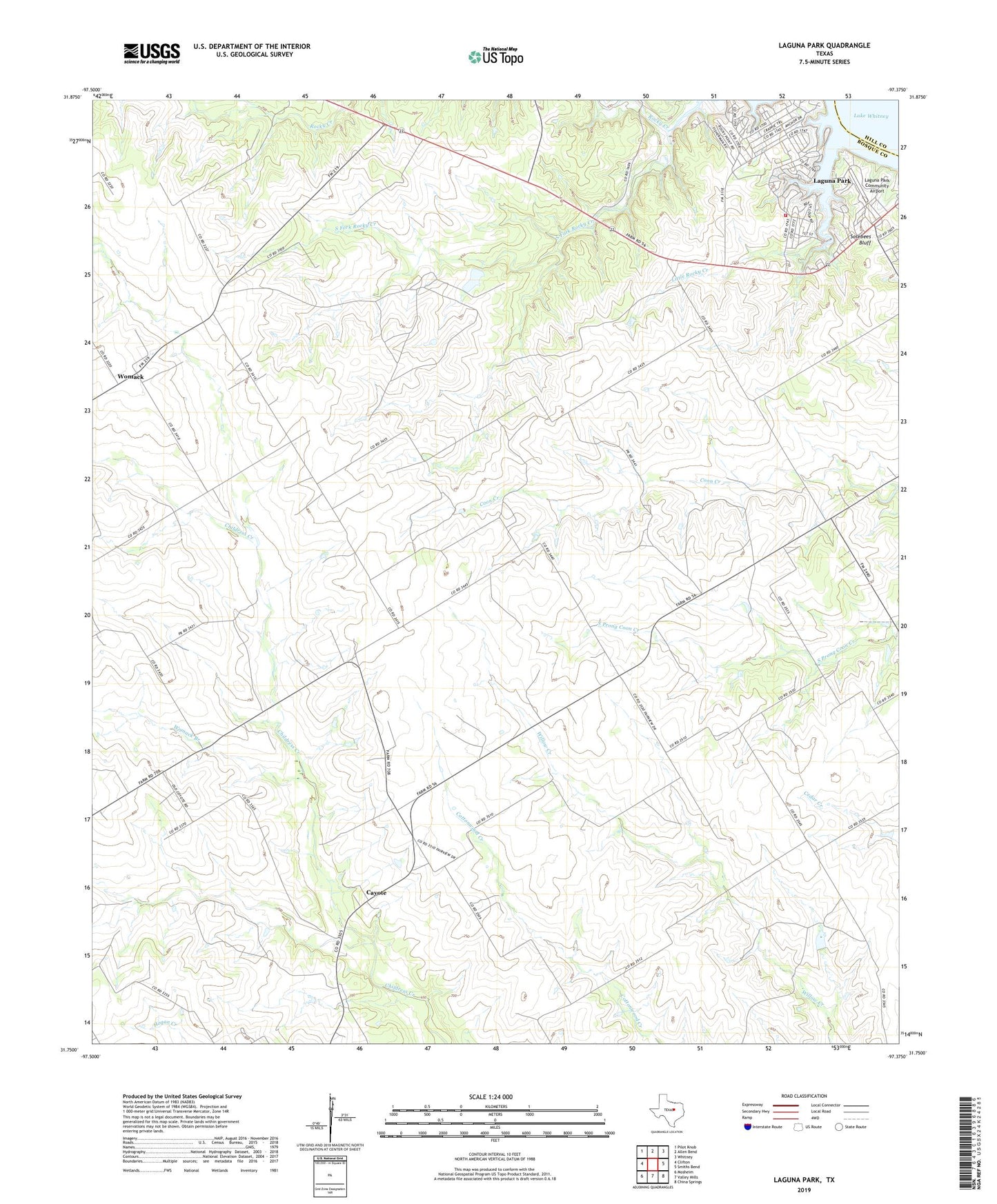
2022 topographic map quadrangle Laguna Park in the state of Texas. Scale: 1:24000. Based on the newly updated USGS 7.5' US Topo map series, this map is in the following counties: Bosque, Hill. The map contains contour data, water features, and other items you are used to seeing on USGS maps, but also has updated roads and other features. This is the next generation of topographic maps. Printed on high-quality waterproof paper with UV fade-resistant inks.
Quads adjacent to this one:
West: Clifton
Northwest: Pilot Knob
North: Allen Bend
Northeast: Whitney
East: Smiths Bend
Southeast: China Springs
South: Valley Mills
Southwest: Mosheim
This map covers the same area as the classic USGS quad with code o31097g4.
Contains the following named places: Bald Eagle Pad, Cayote, Clifton Division, Fairview Church, Flying B Ranch Airport, Kirby Creek, KWOW-FM (Clifton), Laguna Park, Laguna Park Census Designated Place, Laguna Park Community Airport, Little Rocky Creek, South Fork Rocky Creek, West Shore Volunteer Fire Department, Womack, Womack Branch