MyTopo
Colita Texas US Topo Map
Couldn't load pickup availability
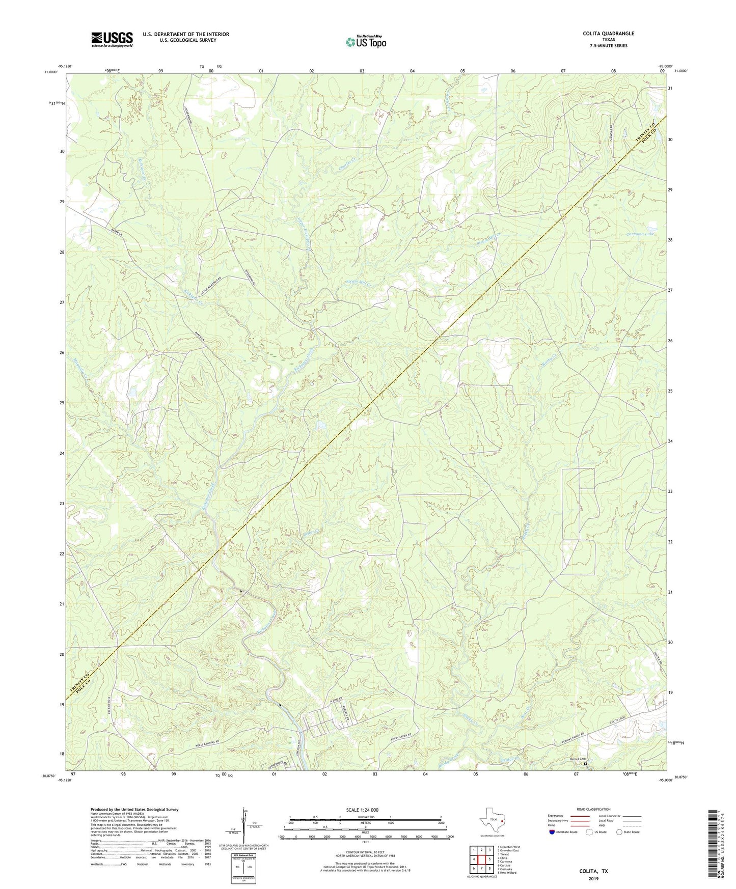
2019 topographic map quadrangle Colita in the state of Texas. Scale: 1:24000. Based on the newly updated USGS 7.5' US Topo map series, this map is in the following counties: Polk, Trinity. The map contains contour data, water features, and other items you are used to seeing on USGS maps, but also has updated roads and other features. This is the next generation of topographic maps. Printed on high-quality waterproof paper with UV fade-resistant inks.
Quads adjacent to this one:
West: Chita
Northwest: Groveton West
North: Groveton East
Northeast: Trevat
East: Carmona
Southeast: New Willard
South: Onalaska
Southwest: Carlisle
Contains the following named places: Bear Creek, Bethel Cemetery, Bridge Creek, Carmona Lake, Carmona Lake Dam, Cedar Creek, Charles Creek, Colita, Colita Church, Kickapoo Creek, Magnolia Creek, Steam Mill Creek, Upper Kickapoo Creek