MyTopo
Chita Texas US Topo Map
Couldn't load pickup availability
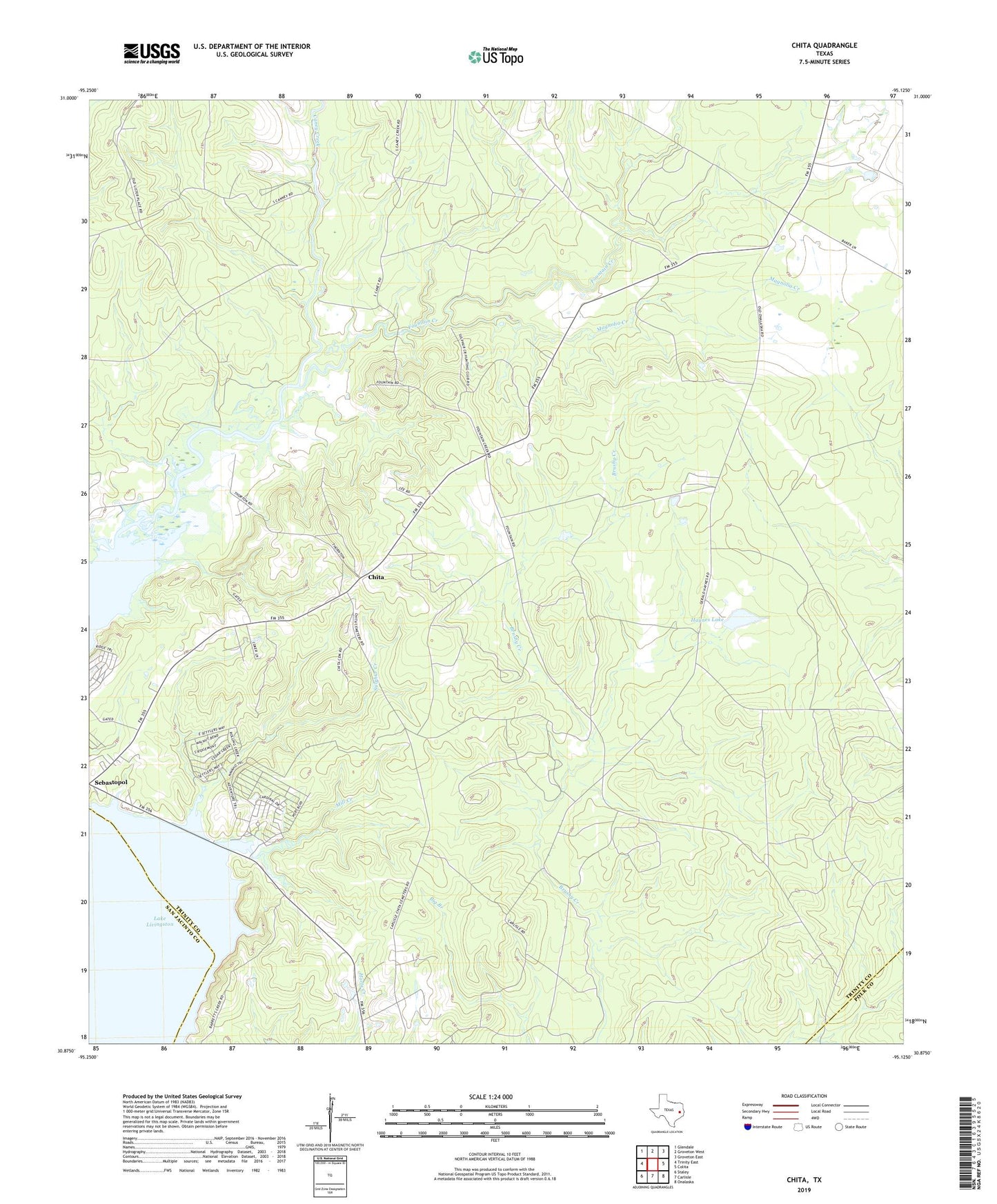
2022 topographic map quadrangle Chita in the state of Texas. Scale: 1:24000. Based on the newly updated USGS 7.5' US Topo map series, this map is in the following counties: Trinity, San Jacinto, Polk. The map contains contour data, water features, and other items you are used to seeing on USGS maps, but also has updated roads and other features. This is the next generation of topographic maps. Printed on high-quality waterproof paper with UV fade-resistant inks.
Quads adjacent to this one:
West: Trinity East
Northwest: Glendale
North: Groveton West
Northeast: Groveton East
East: Colita
Southeast: Onalaska
South: Carlisle
Southwest: Staley
This map covers the same area as the classic USGS quad with code o30095h2.
Contains the following named places: Chita, Fountain Creek, Haynes Lake, Haynes Lake Dam, Magnolia Creek, Magnolia Pumping Station, Mill Creek, Sebastopol, Sulphur Creek