MyTopo
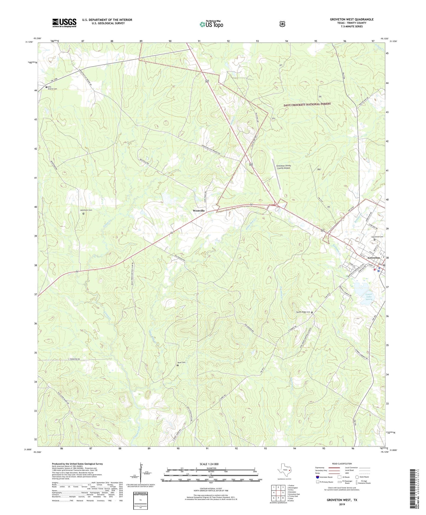
Groveton West Texas US Topo Map
Couldn't load pickup availability
Also explore the Groveton West Forest Service Topo of this same quad for updated USFS data
2022 topographic map quadrangle Groveton West in the state of Texas. Scale: 1:24000. Based on the newly updated USGS 7.5' US Topo map series, this map is in the following counties: Trinity. The map contains contour data, water features, and other items you are used to seeing on USGS maps, but also has updated roads and other features. This is the next generation of topographic maps. Printed on high-quality waterproof paper with UV fade-resistant inks.
Quads adjacent to this one:
West: Glendale
Northwest: Fodice
North: Pennington
Northeast: Crecy
East: Groveton East
Southeast: Colita
South: Chita
Southwest: Trinity East
This map covers the same area as the classic USGS quad with code o31095a2.
Contains the following named places: Avery Lake, Boontown Cemetery, City of Groveton, Dean Cemetery, Ellis Prairie Cemetery, Glenwood Cemetery, Groveton, Groveton City Hall, Groveton Division, Groveton Elementary School, Groveton Fire Station, Groveton Police Department, Groveton Post Office, Groveton-Trinity County Airport, Lower Lake Avery, Lower Lake Avery Dam, New Light Church, Parker Ridge Cemetery, Rose Hill Church, Trinity County, Trinity County Jail, Trinity County Park, Trinity County Sheriff's Office, Upper Lake Avery, Upper Lake Avery Dam, Westville, White Oak Creek