MyTopo
Colliers Creek Texas US Topo Map
Couldn't load pickup availability
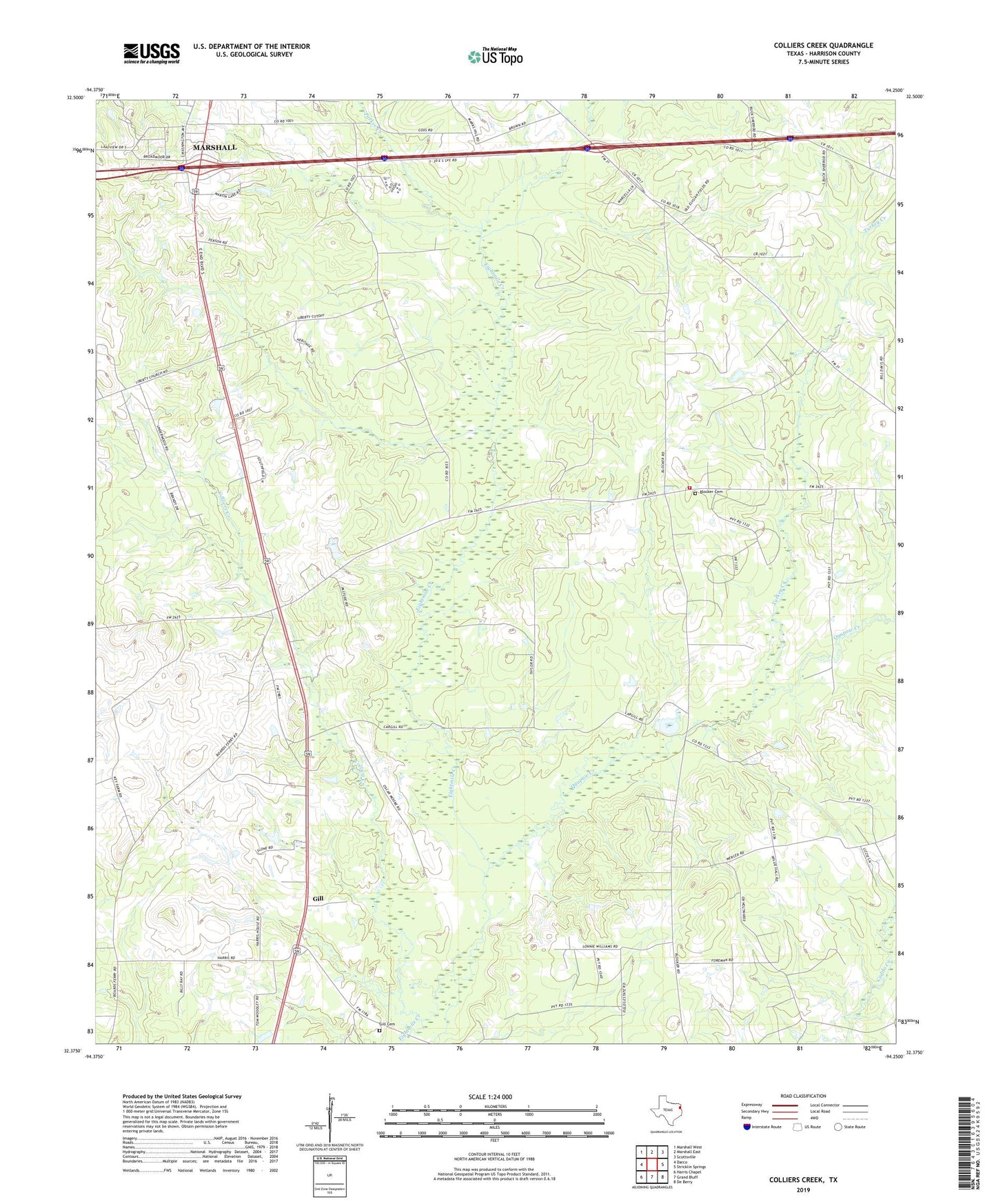
2019 topographic map quadrangle Colliers Creek in the state of Texas. Scale: 1:24000. Based on the newly updated USGS 7.5' US Topo map series, this map is in the following counties: Harrison. The map contains contour data, water features, and other items you are used to seeing on USGS maps, but also has updated roads and other features. This is the next generation of topographic maps. Printed on high-quality waterproof paper with UV fade-resistant inks.
Quads adjacent to this one:
West: Darco
Northwest: Marshall West
North: Marshall East
Northeast: Scottsville
East: Stricklin Springs
Southeast: De Berry
South: Grand Bluff
Southwest: Harris Chapel
Contains the following named places: Blocker Cemetery, Blocker Crossroads Volunteer Fire Department, C Ranch Lake, C Ranch Lake Dam, Club of Christ Hospital, Colliers Creek, Friendship Church, Gill, Gill Cemetery, Harrison County Emergency Services District 4 Station 1, Harrison County Historial Museum, KCUL-AM (Marshall), Liberty Church, Marshall Soccer Complex, Mount School, Paradise Church, Parker Creek, Pine Grove School, Piney Grove Church, Quapaw Creek, Rosenwald Vocational and Agriculture School, Saint John Church, Shady Grove Church, Turkey Creek, Union Church, Zion Church, ZIP Code: 75672