MyTopo
De Berry Texas US Topo Map
Couldn't load pickup availability
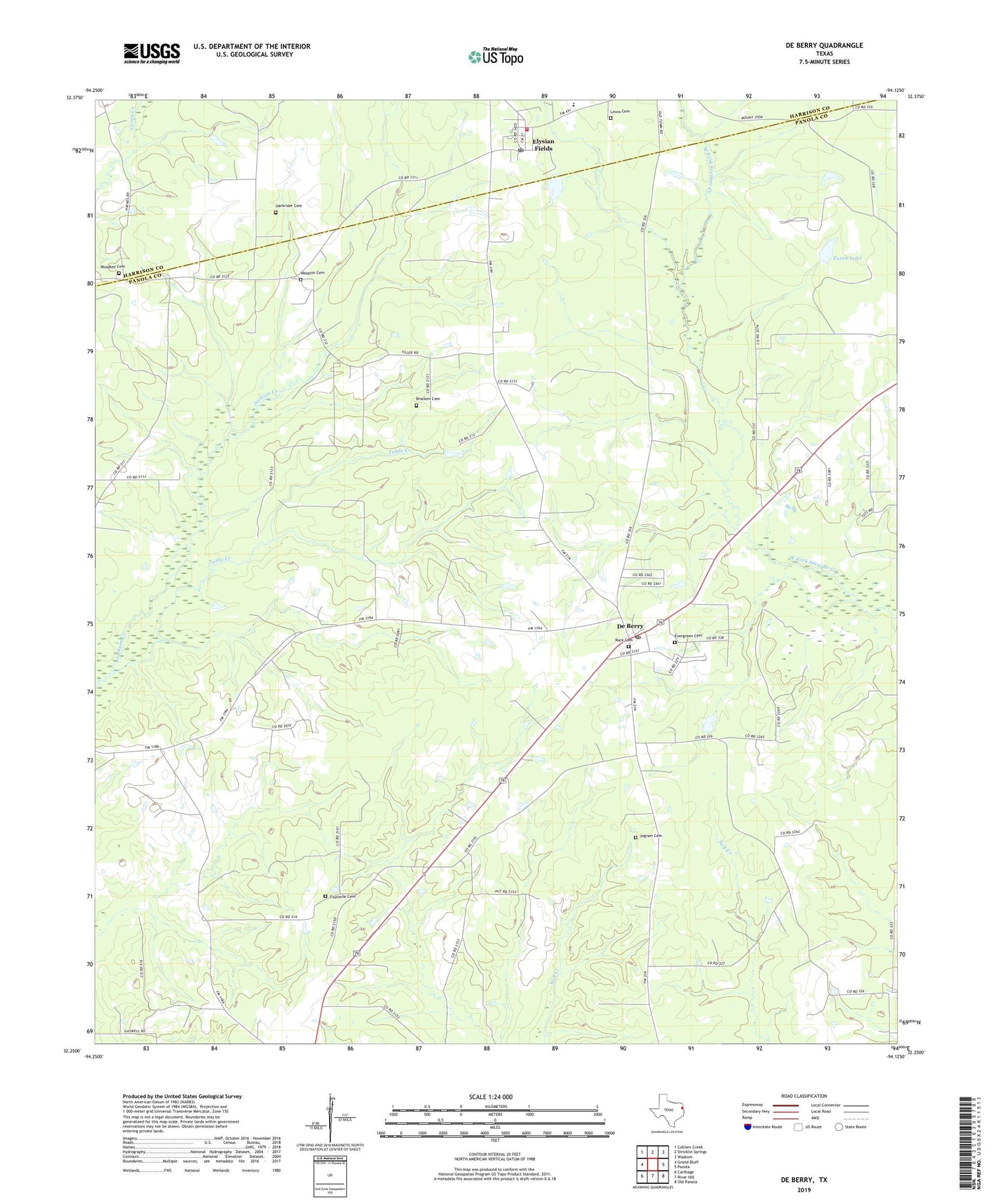
2022 topographic map quadrangle De Berry in the state of Texas. Scale: 1:24000. Based on the newly updated USGS 7.5' US Topo map series, this map is in the following counties: Panola, Harrison. The map contains contour data, water features, and other items you are used to seeing on USGS maps, but also has updated roads and other features. This is the next generation of topographic maps. Printed on high-quality waterproof paper with UV fade-resistant inks.
Quads adjacent to this one:
West: Grand Bluff
Northwest: Colliers Creek
North: Stricklin Springs
Northeast: Waskom
East: Panola
Southeast: Old Panola
South: River Hill
Southwest: Carthage
This map covers the same area as the classic USGS quad with code o32094c2.
Contains the following named places: Bethel Church, Brackens Cemetery, Church of God, De Berry, De Berry Post Office, DeBerry, Elysian Fields, Elysian Fields Church, Elysian Fields Post Office, Elysian Fields Volunteer Fire Department, Evergreen Cemetery, Fourmile Cemetery, Furrh Lake, Furrh Lake Dam, Harkrider Cemetery, Ingram Cemetery, Lewis Cemetery, Lumberton Public Library, Midyett Church, Mims Chapel, Ruck Cemetery, Shadygrove Church, Tabernacle Church, Tuttle Creek, Wayside Church, Welaton Cemetery, Woodley Cemetery, ZIP Codes: 75639, 75642