MyTopo
Comfort Texas US Topo Map
Couldn't load pickup availability
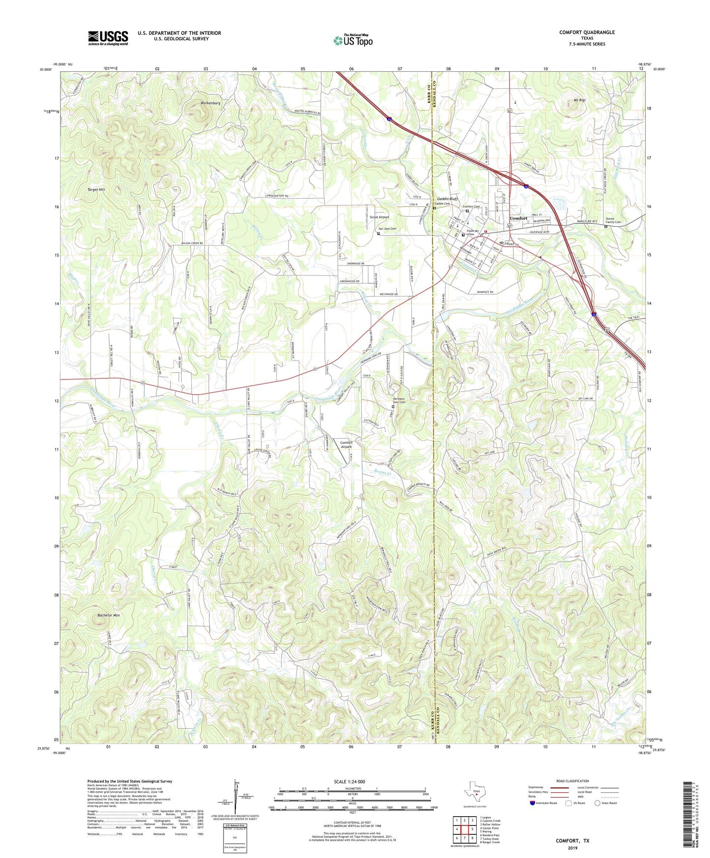
2019 topographic map quadrangle Comfort in the state of Texas. Scale: 1:24000. Based on the newly updated USGS 7.5' US Topo map series, this map is in the following counties: Kerr, Kendall. The map contains contour data, water features, and other items you are used to seeing on USGS maps, but also has updated roads and other features. This is the next generation of topographic maps. Printed on high-quality waterproof paper with UV fade-resistant inks.
Quads adjacent to this one:
West: Center Point
Northwest: Legion
North: Cypress Creek
Northeast: Rafter Hollow
East: Waring
Southeast: Ranger Creek
South: Turkey Knob
Southwest: Bandera Pass
Contains the following named places: Altenheim Cemetery, Bachelor Mountain, Bluff Creek, Bruins Creek, Camp Idlewide, Center Point Division, Cherry Creek, Comfort, Comfort Airpark, Comfort Cemetery, Comfort Census Designated Place, Comfort Elementary School, Comfort High School, Comfort Historic District, Comfort Middle School, Comfort Post Office, Comfort Volunteer Fire Department, Cypress Creek, Gaddis Bluff, Gaddis Cemetery, Hasenwinkel Creek, His Hill Cemetery, Kendall County Constable's Office Precinct 4, Kendall County Emergency Medical Service Substation, Mount Rigi, North Creek, Otto Brinkmann House, San Jose Cemetery, Scout Airport, Steves Family Cemetery, Target Hill, Treue der Union, Treue Der Union Monument, Wilson Creek, Wolkenburg, ZIP Code: 78013