MyTopo
Cypress Creek Texas US Topo Map
Couldn't load pickup availability
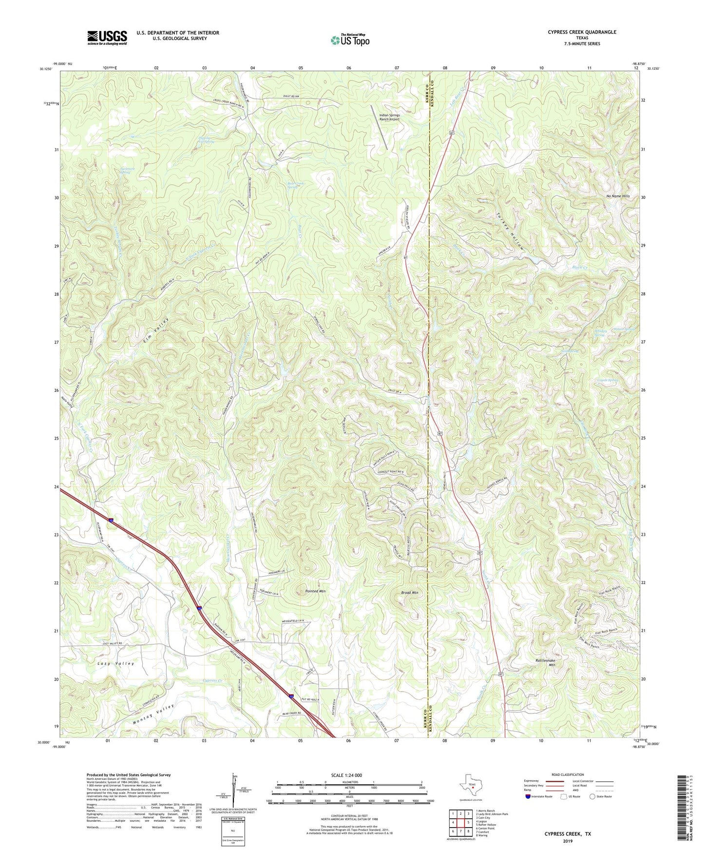
2022 topographic map quadrangle Cypress Creek in the state of Texas. Scale: 1:24000. Based on the newly updated USGS 7.5' US Topo map series, this map is in the following counties: Kerr, Kendall. The map contains contour data, water features, and other items you are used to seeing on USGS maps, but also has updated roads and other features. This is the next generation of topographic maps. Printed on high-quality waterproof paper with UV fade-resistant inks.
Quads adjacent to this one:
West: Legion
Northwest: Morris Ranch
North: Lady Bird Johnson Park
Northeast: Cain City
East: Rafter Hollow
Southeast: Waring
South: Comfort
Southwest: Center Point
This map covers the same area as the classic USGS quad with code o30098a8.
Contains the following named places: Apple Valley, Bear Creek Spring, Broad Mountain, Coyote Spring, Crosscreek Ranch, Cypress Creek, Dipping Vat Spring, Elm Valley, Hasenwinkel Ranch, Hillingdon Ranch, Indian Springs Ranch Airport, Lazy Valley, Montag Valley, Neal Spring, North Fork Cypress Creek, Pointed Mountain, Rattlesnake Mountain, Sycamore Spring, Turkey Bottom Creek, Turkey Hollow, Turkey Hollow Ranch, Whiskey Spring, Wilson Spring