MyTopo
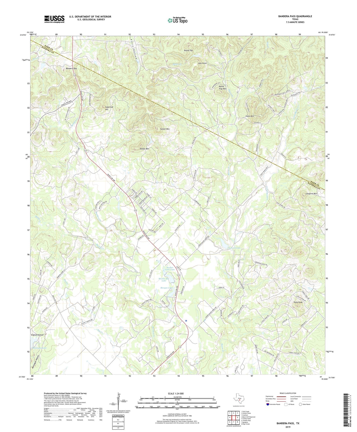
Bandera Pass Texas US Topo Map
Couldn't load pickup availability
2022 topographic map quadrangle Bandera Pass in the state of Texas. Scale: 1:24000. Based on the newly updated USGS 7.5' US Topo map series, this map is in the following counties: Bandera, Kerr. The map contains contour data, water features, and other items you are used to seeing on USGS maps, but also has updated roads and other features. This is the next generation of topographic maps. Printed on high-quality waterproof paper with UV fade-resistant inks.
Quads adjacent to this one:
West: Rock Cliff Reservoir
Northwest: Fall Creek
North: Center Point
Northeast: Comfort
East: Turkey Knob
Southeast: Pipe Creek
South: Bandera
Southwest: Tarpley Pass
This map covers the same area as the classic USGS quad with code o29099g1.
Contains the following named places: Bains Private Airport, Bandera County Sheriff's Office, Bandera Pass, Duffys Mountain, Eagles Roost Airport, Elm Pass, Elm Pass Volunteer Fire Department, English Hollow, H and K Lake, H and K Lake Dam, Joes Point, KHLC-FM (Bandera), Langford Mountain, Little Mason Creek, Montague Lake, Morgan Lake, Morgan Lake Dam, Mosher Big Lake, Mosher Big Lake Dam, Mosher Little Lake, Mosher Little Lake Dam, Myrtle Creek, Nanny Trap Mountain, Polly Peak, Purple Sage Ranch, Purple Sage Ranch Airfield, Round Top, State Mountain, Sugarloaf Hill, Sunset Mountain